Izazi geodata
Izazi (Iringa) is a populated place; located in Tanzania in Africa/Dar_es_Salaam (GMT+3) time zone. With population of 18,010 people, there are 151 cities with bigger population in this country. Compared to other cities in Tanzania, 68.5% of cities are located further ↑North; 54.9% of cities are located further ←West and 65% of cities have higher elevation than Izazi. Note1


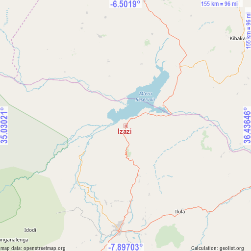
Izazi GPS coordinates[2]
7° 12' 0" South, 35° 43' 59.988" East
| Map corner | latitude | longitude |
|---|---|---|
| Upper-left | -6.5019°, | 35.03021° |
| Center: | -7.2°, | 35.73333° |
| Lower-right: | -7.89703°, | 36.43646° |
| Map W x H: | 155.1×155.1 km | = 96.4×96.4mi |
| max Lat: | -1.14389° ⇑68.5% North |
| Izazi: | -7.2° |
| min Lat: | ⇓31.5% South -11.36667° |
| min Long | Izazi | max Long |
| 29.62667° | 35.73333° | 40.33333° |
| W 54.9%⇐ | ⇒45.1% E |
Elevation
Elevation of Izazi is 727 m = 2385 ft, and this is 215.8 m = 708 ft below average elevation for this country.
| Max E: |
2377 m = 7799 ft | 65% |
| Avg. | 942.8 m = 3093 ft | |
| Izazi | 727 m = 2385 ft | |
Min E: |
0 m = 0 ft | 35% |
See also: Tanzania elevation on elevation.city.
Geographical zone
Izazi is located in South Torrid zone (between Equator and Tropic of Capricorn). Distance of Equator is 800.6 km =497.5 mi to North.| Distance of | km | miles | from Izazi |
|---|---|---|---|
| Equator | 800.6 | 497.5 | to North |
| Tropic Capricorn | 1805.4 | 1121.8 | to South |
| Antarctic Circle | 6600.6 | 4101.4 | to South |
| South Pole | 9206.5 | 5720.7 | to South |


Nearby cities:
15 places around Izazi: (largest is in red/bold)
• Dodoma
114.3 km =71 mi,  0°
0°
• Ifakara
147.4 km =91.6 mi,  134°
134°
• Ilula
62.7 km =39 mi,  147°
147°
• Iringa
63.1 km =39.2 mi,  183°
183°
• Kibakwe
88.2 km =54.8 mi,  52°
52°
• Kidatu
145.9 km =90.7 mi,  112°
112°
• Kidodi
147.2 km =91.5 mi, 107°
• Kilosa
143.8 km =89.4 mi,  73°
73°
• Kintinku
156.5 km =97.2 mi,  339°
339°
• Kisasa
114.1 km =70.9 mi, 3°
• Kongwa
134.4 km =83.5 mi,  34°
34°
• Mafinga
73.7 km =45.8 mi,  265°
265°
• Mikumi
139.7 km =86.8 mi,  99°
99°
• Mpwapwa
125.7 km =78.1 mi,  41°
41°
• Msanga
132.1 km =82.1 mi,  14°
14°
Sources, notices
• [Note1] Compared only with cities in Tanzania existing in our database
• [Src1] Map data: © OpenStreetMap contributors (CC-BY-SA)
• [Src2] Other city data from geonames.org with taken over terms of usage.
• [Src3] Geographical zone / Annual Mean Temperature by Robert A. Rohde @ Wikipedia
