Kisasa geodata
Kisasa (Dodoma) is a populated place; located in Tanzania in Africa/Dar_es_Salaam (GMT+3) time zone. With population of 10,000 people, there are 238 cities with bigger population in this country. Compared to other cities in Tanzania, 58% of cities are located further ↑North; 56.6% of cities are located further ←West and 51.7% of cities have higher elevation than Kisasa. Note1


Kisasa GPS coordinates[2]
6° 10' 30.936" South, 35° 47' 33.576" East
| Map corner | latitude | longitude |
|---|---|---|
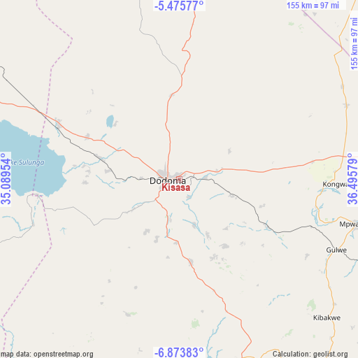
| Upper-left | -5.47577°, | 35.08954° |
| Center: | -6.17526°, | 35.79266° |
| Lower-right: | -6.87383°, | 36.49579° |
| Map W x H: | 155.4×155.5 km | = 96.6×96.6mi |
| max Lat: | -1.14389° ⇑58% North |
| Kisasa: | -6.17526° |
| min Lat: | ⇓42% South -11.36667° |
| min Long | Kisasa | max Long |
| 29.62667° | 35.79266° | 40.33333° |
| W 56.6%⇐ | ⇒43.4% E |
Elevation
Elevation of Kisasa is 1117 m = 3665 ft, and this is 174.2 m = 572 ft above average elevation for this country.
| Max E: |
2377 m = 7799 ft | 51.7% |
| Kisasa | 1117 m 3665 ft | |
| Avg. | 942.8 m = 3093 ft | |
Min E: |
0 m = 0 ft | 48.3% |
See also: Tanzania elevation on elevation.city.
Geographical zone
Kisasa is located in South Torrid zone (between Equator and Tropic of Capricorn). Distance of Equator is 686.6 km =426.6 mi to North.| Distance of | km | miles | from Kisasa |
|---|---|---|---|
| Equator | 686.6 | 426.6 | to North |
| Tropic Capricorn | 1919.3 | 1192.6 | to South |
| Antarctic Circle | 6714.5 | 4172.2 | to South |
| South Pole | 9320.4 | 5791.4 | to South |


Nearby cities:
15 places around Kisasa: (largest is in red/bold)
• Dodoma
5.9 km =3.7 mi,  273°
273°
• Geiro
118.8 km =73.8 mi,  88°
88°
• Itigi
154.1 km =95.8 mi,  290°
290°
• Izazi
114.1 km =70.9 mi,  183°
183°
• Kibakwe
87.4 km =54.3 mi,  133°
133°
• Kibaya
129.6 km =80.5 mi,  41°
41°
• Kilimatinde
100 km =62.1 mi, 291°
• Kilosa
150.5 km =93.5 mi,  119°
119°
• Kintinku
69.8 km =43.4 mi,  297°
297°
• Kondoa
141.8 km =88.1 mi,  359°
359°
• Kongwa
69 km =42.9 mi, 92°
• Mafinga
143.9 km =89.4 mi,  213°
213°
• Mpwapwa
78.8 km =49 mi,  104°
104°
• Msanga
30 km =18.6 mi,  62°
62°
• Msowero
160.5 km =99.7 mi, 104°
Sources, notices
• [Note1] Compared only with cities in Tanzania existing in our database
• [Src1] Map data: © OpenStreetMap contributors (CC-BY-SA)
• [Src2] Other city data from geonames.org with taken over terms of usage.
• [Src3] Geographical zone / Annual Mean Temperature by Robert A. Rohde @ Wikipedia
