Msanga geodata
Msanga (Dodoma) is a populated place; located in Tanzania in Africa/Dar_es_Salaam (GMT+3) time zone. With population of 5,527 people, there are 270 cities with bigger population in this country. Compared to other cities in Tanzania, 55.9% of cities are located further ↑North; 58% of cities are located further ←West and 57% of cities have higher elevation than Msanga. Note1


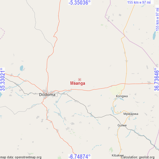
Msanga GPS coordinates[2]
6° 3' 0" South, 36° 1' 59.988" East
| Map corner | latitude | longitude |
|---|---|---|
| Upper-left | -5.35036°, | 35.33021° |
| Center: | -6.05°, | 36.03333° |
| Lower-right: | -6.74874°, | 36.73646° |
| Map W x H: | 155.5×155.5 km | = 96.6×96.6mi |
| max Lat: | -1.14389° ⇑55.9% North |
| Msanga: | -6.05° |
| min Lat: | ⇓44.1% South -11.36667° |
| min Long | Msanga | max Long |
| 29.62667° | 36.03333° | 40.33333° |
| W 58%⇐ | ⇒42% E |
Elevation
Elevation of Msanga is 1012 m = 3320 ft, and this is 69.2 m = 227 ft above average elevation for this country.
| Max E: |
2377 m = 7799 ft | 57% |
| Msanga | 1012 m 3320 ft | |
| Avg. | 942.8 m = 3093 ft | |
Min E: |
0 m = 0 ft | 43% |
See also: Tanzania elevation on elevation.city.
Geographical zone
Msanga is located in South Torrid zone (between Equator and Tropic of Capricorn). Distance of Equator is 672.7 km =418 mi to North.| Distance of | km | miles | from Msanga |
|---|---|---|---|
| Equator | 672.7 | 418 | to North |
| Tropic Capricorn | 1933.2 | 1201.2 | to South |
| Antarctic Circle | 6728.5 | 4180.9 | to South |
| South Pole | 9334.4 | 5800.1 | to South |


Nearby cities:
15 places around Msanga: (largest is in red/bold)
• Dodoma
35.2 km =21.9 mi,  247°
247°
• Geiro
92.8 km =57.7 mi,  96°
96°
• Izazi
132.1 km =82.1 mi,  194°
194°
• Kibakwe
82.8 km =51.4 mi,  153°
153°
• Kibaya
102.2 km =63.5 mi,  35°
35°
• Kilimatinde
121.9 km =75.7 mi,  280°
280°
• Kilosa
136.4 km =84.8 mi,  129°
129°
• Kimamba
146.4 km =91 mi,  123°
123°
• Kintinku
90.4 km =56.2 mi, 281°
• Kisasa
30 km =18.6 mi,  242°
242°
• Kondoa
130.8 km =81.3 mi,  347°
347°
• Kongwa
45.5 km =28.3 mi,  111°
111°
• Magole
152.6 km =94.8 mi, 103°
• Mpwapwa
59.9 km =37.2 mi, 123°
• Msowero
139.7 km =86.8 mi, 112°
Sources, notices
• [Note1] Compared only with cities in Tanzania existing in our database
• [Src1] Map data: © OpenStreetMap contributors (CC-BY-SA)
• [Src2] Other city data from geonames.org with taken over terms of usage.
• [Src3] Geographical zone / Annual Mean Temperature by Robert A. Rohde @ Wikipedia
