Yur”yivka geodata
Yur”yivka (Dnipropetrovsk) is a seat of a second-order administrative division; located in Ukraine in Europe/Kiev (GMT+3) time zone. In our database, there are 1661 cities with bigger population. Compared to other cities in Ukraine, 61.2% of cities are located further ↓South; 86.9% of cities are located further ←West and 69.2% of cities have higher elevation than Yur”yivka. Note1


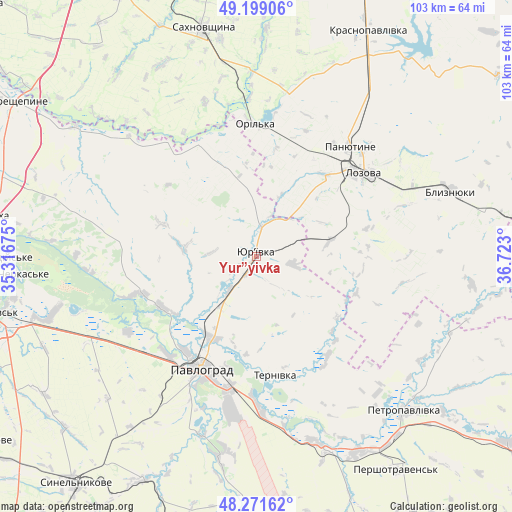
Yur”yivka GPS coordinates[2]
48° 44' 14.928" North, 36° 1' 11.532" East
| Map corner | latitude | longitude |
|---|---|---|
| Upper-left | 49.19906°, | 35.31675° |
| Center: | 48.73748°, | 36.01987° |
| Lower-right: | 48.27162°, | 36.723° |
| Map W x H: | 103.1×103.1 km | = 64.1×64.1mi |
| max Lat: | 52.18903° ⇑38.8% North |
| Yur”yivka: | 48.73748° |
| min Lat: | ⇓61.2% South 44.39214° |
| min Long | Yur”yivka | max Long |
| 22.20555° | 36.01987° | 40.13222° |
| W 86.9%⇐ | ⇒13.1% E |
Elevation
Elevation of Yur”yivka is 77 m = 253 ft, and this is 78.8 m = 259 ft below average elevation for this country.
| Max E: |
886 m = 2907 ft | 69.2% |
| Avg. | 155.8 m = 511 ft | |
| Yur”yivka | 77 m = 253 ft | |
Min E: |
-3 m = -10 ft | 30.8% |
See also: Ukraine elevation on elevation.city.
Geographical zone
Yur”yivka is located in North temperate zone (between Tropic of Cancer and the Arctic Circle). Distance of this North polar circle is 1982.1 km =1231.6 mi to North.| Distance of | km | miles | from Yur”yivka |
|---|---|---|---|
| North Pole | 4588 | 2850.9 | to North |
| Arctic Circle | 1982.1 | 1231.6 | to North |
| Tropic Cancer | 2813.2 | 1748 | to South |
| Equator | 5419.1 | 3367.3 | to South |


Nearby cities:
15 places around Yur”yivka: (largest is in red/bold)
• Blyznyuky
41.4 km =25.7 mi,  71°
71°
• Hubynykha
56.5 km =35.1 mi,  278°
278°
• Kehychivka
63.9 km =39.7 mi,  342°
342°
• Khashchevoye
50 km =31.1 mi,  265°
265°
• Krasnopavlivka
49.5 km =30.8 mi,  26°
26°
• Lozova
27.6 km =17.1 mi,  52°
52°
• Melioratyvne
45.9 km =28.5 mi,  254°
254°
• Novomoskovs’k
57.9 km =36 mi,  258°
258°
• Panyutyne
29 km =18 mi,  40°
40°
• Pavlohrad
25.1 km =15.6 mi,  205°
205°
• Petropavlivka
43.8 km =27.2 mi,  135°
135°
• Sakhnovshchyna
47.3 km =29.4 mi,  346°
346°
• Synel’nykove
59.3 km =36.8 mi,  218°
218°
• Tymchenky
54.7 km =34 mi,  9°
9°
• Vasyl’kivka
59 km =36.7 mi,  179°
179°
Sources, notices
• [Note1] Compared only with cities in Ukraine existing in our database
• [Src1] Map data: © OpenStreetMap contributors (CC-BY-SA)
• [Src2] Other city data from geonames.org with taken over terms of usage.
• [Src3] Geographical zone / Annual Mean Temperature by Robert A. Rohde @ Wikipedia
