Sakhnovshchyna geodata
Sakhnovshchyna (Kharkiv) is a seat of a second-order administrative division; located in Ukraine in Europe/Kiev (GMT+3) time zone. With population of 8,188 people, there are 432 cities with bigger population in this country. Compared to other cities in Ukraine, 69.1% of cities are located further ↓South; 86.4% of cities are located further ←West and 60.1% of cities have lower elevation than Sakhnovshchyna. Note1


Sakhnovshchyna GPS coordinates[2]
49° 9' 5.976" North, 35° 52' 19.128" East
| Map corner | latitude | longitude |
|---|---|---|
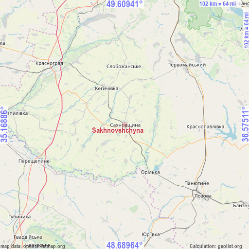
| Upper-left | 49.60941°, | 35.16886° |
| Center: | 49.15166°, | 35.87198° |
| Lower-right: | 48.68964°, | 36.57511° |
| Map W x H: | 102.3×102.3 km | = 63.6×63.6mi |
| max Lat: | 52.18903° ⇑30.9% North |
| Sakhnovshchyna: | 49.15166° |
| min Lat: | ⇓69.1% South 44.39214° |
| min Long | Sakhnovshchyna | max Long |
| 22.20555° | 35.87198° | 40.13222° |
| W 86.4%⇐ | ⇒13.6% E |
Elevation
Elevation of Sakhnovshchyna is 169 m = 554 ft, and this is 13.2 m = 43 ft above average elevation for this country.
| Max E: |
886 m = 2907 ft | 39.9% |
| Sakhnovshchyna | 169 m 554 ft | |
| Avg. | 155.8 m = 511 ft | |
Min E: |
-3 m = -10 ft | 60.1% |
See also: Ukraine elevation on elevation.city.
Geographical zone
Sakhnovshchyna is located in North temperate zone (between Tropic of Cancer and the Arctic Circle). Distance of this North polar circle is 1936 km =1203 mi to North.| Distance of | km | miles | from Sakhnovshchyna |
|---|---|---|---|
| North Pole | 4541.9 | 2822.2 | to North |
| Arctic Circle | 1936 | 1203 | to North |
| Tropic Cancer | 2859.2 | 1776.6 | to South |
| Equator | 5465.2 | 3395.9 | to South |


Nearby cities:
15 places around Sakhnovshchyna: (largest is in red/bold)
• Berezivka
34.1 km =21.2 mi,  339°
339°
• Blyznyuky
59.6 km =37 mi,  123°
123°
• Chapayeve
23.9 km =14.9 mi,  0°
0°
• Hubynykha
58.9 km =36.6 mi,  229°
229°
• Kehychivka
17 km =10.6 mi,  331°
331°
• Krasnohrad
40.2 km =25 mi,  309°
309°
• Krasnopavlivka
32.6 km =20.3 mi,  92°
92°
• Lozova
43.7 km =27.2 mi,  131°
131°
• Nova Vodolaha
63.1 km =39.2 mi,  359°
359°
• Panyutyne
37.9 km =23.5 mi, 129°
• Pervomays’kyy
36.1 km =22.4 mi,  43°
43°
• Tymchenky
21.2 km =13.2 mi,  67°
67°
• Verbivka
38.4 km =23.9 mi,  320°
320°
• Yur”yivka
47.3 km =29.4 mi,  166°
166°
• Zachepylivka
46.2 km =28.7 mi,  275°
275°
Sources, notices
• [Note1] Compared only with cities in Ukraine existing in our database
• [Src1] Map data: © OpenStreetMap contributors (CC-BY-SA)
• [Src2] Other city data from geonames.org with taken over terms of usage.
• [Src3] Geographical zone / Annual Mean Temperature by Robert A. Rohde @ Wikipedia
