Vasyl’kivka geodata
Vasyl’kivka (Dnipropetrovsk) is a seat of a second-order administrative division; located in Ukraine in Europe/Kiev (GMT+3) time zone. In our database, there are 1661 cities with bigger population. Compared to other cities in Ukraine, 52.2% of cities are located further ↑North; 87% of cities are located further ←West and 69.2% of cities have higher elevation than Vasyl’kivka. Note1


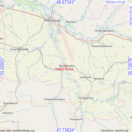
Vasyl’kivka GPS coordinates[2]
48° 12' 25.128" North, 36° 1' 25.14" East
| Map corner | latitude | longitude |
|---|---|---|
| Upper-left | 48.67343°, | 35.32053° |
| Center: | 48.20698°, | 36.02365° |
| Lower-right: | 47.73624°, | 36.72678° |
| Map W x H: | 104.2×104.2 km | = 64.7×64.7mi |
| max Lat: | 52.18903° ⇑52.2% North |
| Vasyl’kivka: | 48.20698° |
| min Lat: | ⇓47.8% South 44.39214° |
| min Long | Vasyl’kivka | max Long |
| 22.20555° | 36.02365° | 40.13222° |
| W 87%⇐ | ⇒13% E |
Elevation
Elevation of Vasyl’kivka is 77 m = 253 ft, and this is 78.8 m = 259 ft below average elevation for this country.
| Max E: |
886 m = 2907 ft | 69.2% |
| Avg. | 155.8 m = 511 ft | |
| Vasyl’kivka | 77 m = 253 ft | |
Min E: |
-3 m = -10 ft | 30.8% |
See also: Ukraine elevation on elevation.city.
Geographical zone
Vasyl’kivka is located in North temperate zone (between Tropic of Cancer and the Arctic Circle). Distance of this North polar circle is 2041.1 km =1268.3 mi to North.| Distance of | km | miles | from Vasyl’kivka |
|---|---|---|---|
| North Pole | 4646.9 | 2887.4 | to North |
| Arctic Circle | 2041.1 | 1268.3 | to North |
| Tropic Cancer | 2754.2 | 1711.4 | to South |
| Equator | 5360.1 | 3330.6 | to South |


Nearby cities:
15 places around Vasyl’kivka: (largest is in red/bold)
• Hulyaypole
62.8 km =39 mi,  163°
163°
• Kaydaki
69.2 km =43 mi,  285°
285°
• Kirove
66.3 km =41.2 mi,  201°
201°
• Komyshuvakha
65.8 km =40.9 mi,  213°
213°
• Melioratyvne
65 km =40.4 mi,  316°
316°
• Mezhova
52.9 km =32.9 mi,  84°
84°
• Novomykolayivka
26.8 km =16.7 mi, 198°
• Pavlohrad
38.1 km =23.7 mi,  342°
342°
• Petropavlivka
41.2 km =25.6 mi,  47°
47°
• Pokrovs’ke
29.5 km =18.3 mi,  149°
149°
• Synel’nykove
39.5 km =24.5 mi, 288°
• Ternuvate
42.6 km =26.5 mi,  169°
169°
• Vil’nyans’k
52.6 km =32.7 mi,  236°
236°
• Yur”yivka
59 km =36.7 mi,  359°
359°
• Zaliznychne
62.6 km =38.9 mi, 170°
Sources, notices
• [Note1] Compared only with cities in Ukraine existing in our database
• [Src1] Map data: © OpenStreetMap contributors (CC-BY-SA)
• [Src2] Other city data from geonames.org with taken over terms of usage.
• [Src3] Geographical zone / Annual Mean Temperature by Robert A. Rohde @ Wikipedia
