Kosiv geodata
Kosiv (Ivano-Frankivsk) is a seat of a second-order administrative division; located in Ukraine in Europe/Kiev (GMT+3) time zone. With population of 7,992 people, there are 448 cities with bigger population in this country. Compared to other cities in Ukraine, 50.1% of cities are located further ↓South; 85.6% of cities are located further →East and 95.5% of cities have lower elevation than Kosiv. Note1


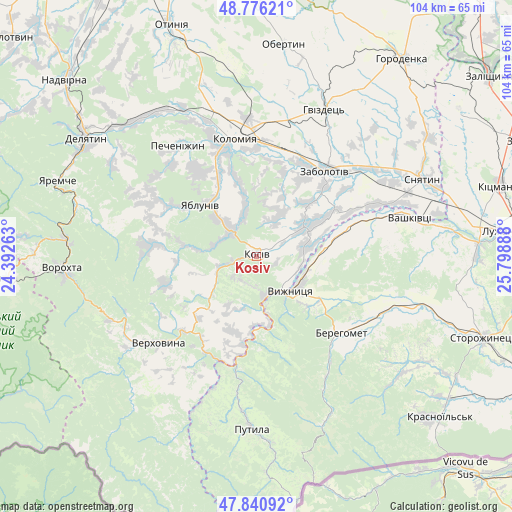
Kosiv GPS coordinates[2]
48° 18' 38.556" North, 25° 5' 44.7" East
| Map corner | latitude | longitude |
|---|---|---|
| Upper-left | 48.77621°, | 24.39263° |
| Center: | 48.31071°, | 25.09575° |
| Lower-right: | 47.84092°, | 25.79888° |
| Map W x H: | 104×104 km | = 64.6×64.6mi |
| max Lat: | 52.18903° ⇑49.9% North |
| Kosiv: | 48.31071° |
| min Lat: | ⇓50.1% South 44.39214° |
| min Long | Kosiv | max Long |
| 22.20555° | 25.09575° | 40.13222° |
| W 14.4%⇐ | ⇒85.6% E |
Elevation
Elevation of Kosiv is 369 m = 1211 ft, and this is 213.2 m = 699 ft above average elevation for this country.
| Max E: |
886 m = 2907 ft | 4.5% |
| Kosiv | 369 m 1211 ft | |
| Avg. | 155.8 m = 511 ft | |
Min E: |
-3 m = -10 ft | 95.5% |
See also: Ukraine elevation on elevation.city.
Geographical zone
Kosiv is located in North temperate zone (between Tropic of Cancer and the Arctic Circle). Distance of this North polar circle is 2029.5 km =1261.1 mi to North.| Distance of | km | miles | from Kosiv |
|---|---|---|---|
| North Pole | 4635.4 | 2880.3 | to North |
| Arctic Circle | 2029.5 | 1261.1 | to North |
| Tropic Cancer | 2765.7 | 1718.5 | to South |
| Equator | 5371.6 | 3337.8 | to South |


Nearby cities:
15 places around Kosiv: (largest is in red/bold)
• Banyliv
19.5 km =12.1 mi,  71°
71°
• Berehomet
23.8 km =14.8 mi,  128°
128°
• Ispas
13.3 km =8.3 mi,  96°
96°
• Khymchyn
9.3 km =5.8 mi,  24°
24°
• Kosmach
20.5 km =12.7 mi,  275°
275°
• Kuty
8.5 km =5.3 mi, 133°
• Rechka
12.5 km =7.8 mi,  254°
254°
• Rozhniv
11.4 km =7.1 mi,  57°
57°
• Sheshory
8.6 km =5.3 mi,  285°
285°
• Stari Kuty
7.2 km =4.5 mi, 127°
• Velykyy Klyuchiv
20.9 km =13 mi,  328°
328°
• Verkhniy Yasenov
20 km =12.4 mi,  213°
213°
• Vyzhnytsya
10.1 km =6.3 mi, 133°
• Yabluniv
15.6 km =9.7 mi,  311°
311°
• Zabolotiv
22.6 km =14 mi,  38°
38°
Sources, notices
• [Note1] Compared only with cities in Ukraine existing in our database
• [Src1] Map data: © OpenStreetMap contributors (CC-BY-SA)
• [Src2] Other city data from geonames.org with taken over terms of usage.
• [Src3] Geographical zone / Annual Mean Temperature by Robert A. Rohde @ Wikipedia
