Kuty geodata
Kuty (Ivano-Frankivsk) is a populated place; located in Ukraine in Europe/Kiev (GMT+3) time zone. With population of 4,160 people, there are 742 cities with bigger population in this country. Compared to other cities in Ukraine, 50.9% of cities are located further ↑North; 85% of cities are located further →East and 92.8% of cities have lower elevation than Kuty. Note1


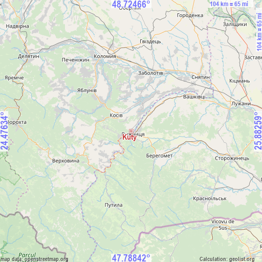
Kuty GPS coordinates[2]
48° 15' 31.248" North, 25° 10' 46.056" East
| Map corner | latitude | longitude |
|---|---|---|
| Upper-left | 48.72466°, | 24.47634° |
| Center: | 48.25868°, | 25.17946° |
| Lower-right: | 47.78842°, | 25.88259° |
| Map W x H: | 104.1×104.1 km | = 64.7×64.7mi |
| max Lat: | 52.18903° ⇑50.9% North |
| Kuty: | 48.25868° |
| min Lat: | ⇓49.1% South 44.39214° |
| min Long | Kuty | max Long |
| 22.20555° | 25.17946° | 40.13222° |
| W 15%⇐ | ⇒85% E |
Elevation
Elevation of Kuty is 328 m = 1076 ft, and this is 172.2 m = 565 ft above average elevation for this country.
| Max E: |
886 m = 2907 ft | 7.2% |
| Kuty | 328 m 1076 ft | |
| Avg. | 155.8 m = 511 ft | |
Min E: |
-3 m = -10 ft | 92.8% |
See also: Ukraine elevation on elevation.city.
Geographical zone
Kuty is located in North temperate zone (between Tropic of Cancer and the Arctic Circle). Distance of this North polar circle is 2035.3 km =1264.7 mi to North.| Distance of | km | miles | from Kuty |
|---|---|---|---|
| North Pole | 4641.2 | 2883.9 | to North |
| Arctic Circle | 2035.3 | 1264.7 | to North |
| Tropic Cancer | 2759.9 | 1714.9 | to South |
| Equator | 5365.9 | 3334.2 | to South |


Nearby cities:
15 places around Kuty: (largest is in red/bold)
• Banyliv
17.1 km =10.6 mi,  45°
45°
• Berehomet
15.4 km =9.6 mi,  125°
125°
• Ispas
8.2 km =5.1 mi,  58°
58°
• Khymchyn
14.4 km =8.9 mi,  350°
350°
• Kosiv
8.5 km =5.3 mi,  313°
313°
• Kosmach
27.7 km =17.2 mi,  286°
286°
• Myhove
18.6 km =11.6 mi, 127°
• Rechka
18.4 km =11.4 mi,  277°
277°
• Rozhniv
12.4 km =7.7 mi,  16°
16°
• Sheshory
16.6 km =10.3 mi,  299°
299°
• Stari Kuty
1.4 km =0.9 mi,  340°
340°
• Verkhniy Yasenov
20.4 km =12.7 mi,  238°
238°
• Vyzhnytsya
1.6 km =1 mi,  136°
136°
• Yabluniv
24 km =14.9 mi, 312°
• Zabolotiv
24.8 km =15.4 mi, 18°
Sources, notices
• [Note1] Compared only with cities in Ukraine existing in our database
• [Src1] Map data: © OpenStreetMap contributors (CC-BY-SA)
• [Src2] Other city data from geonames.org with taken over terms of usage.
• [Src3] Geographical zone / Annual Mean Temperature by Robert A. Rohde @ Wikipedia
