Sheshory geodata
Sheshory (Ivano-Frankivsk) is a populated place; located in Ukraine in Europe/Kiev (GMT+3) time zone. With population of 1,984 people, there are 1114 cities with bigger population in this country. Compared to other cities in Ukraine, 50.9% of cities are located further ↓South; 85.9% of cities are located further →East and 97.2% of cities have lower elevation than Sheshory. Note1


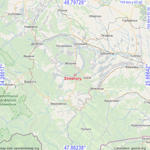
Sheshory GPS coordinates[2]
48° 19' 55.092" North, 24° 58' 59.844" East
| Map corner | latitude | longitude |
|---|---|---|
| Upper-left | 48.79728°, | 24.28017° |
| Center: | 48.33197°, | 24.98329° |
| Lower-right: | 47.86238°, | 25.68642° |
| Map W x H: | 104×103.9 km | = 64.6×64.6mi |
| max Lat: | 52.18903° ⇑49.1% North |
| Sheshory: | 48.33197° |
| min Lat: | ⇓50.9% South 44.39214° |
| min Long | Sheshory | max Long |
| 22.20555° | 24.98329° | 40.13222° |
| W 14.1%⇐ | ⇒85.9% E |
Elevation
Elevation of Sheshory is 432 m = 1417 ft, and this is 276.2 m = 906 ft above average elevation for this country.
| Max E: |
886 m = 2907 ft | 2.8% |
| Sheshory | 432 m 1417 ft | |
| Avg. | 155.8 m = 511 ft | |
Min E: |
-3 m = -10 ft | 97.2% |
See also: Ukraine elevation on elevation.city.
Geographical zone
Sheshory is located in North temperate zone (between Tropic of Cancer and the Arctic Circle). Distance of this North polar circle is 2027.2 km =1259.6 mi to North.| Distance of | km | miles | from Sheshory |
|---|---|---|---|
| North Pole | 4633.1 | 2878.9 | to North |
| Arctic Circle | 2027.2 | 1259.6 | to North |
| Tropic Cancer | 2768.1 | 1720 | to South |
| Equator | 5374 | 3339.2 | to South |


Nearby cities:
15 places around Sheshory: (largest is in red/bold)
• Ispas
21.8 km =13.5 mi,  100°
100°
• Khymchyn
13.6 km =8.5 mi,  63°
63°
• Kolomyia
22.5 km =14 mi,  10°
10°
• Kosiv
8.6 km =5.3 mi,  105°
105°
• Kosmach
12 km =7.5 mi,  268°
268°
• Kuty
16.6 km =10.3 mi,  119°
119°
• Pechenizhyn
21.4 km =13.3 mi,  342°
342°
• Rechka
6.8 km =4.2 mi,  212°
212°
• Rozhniv
18.3 km =11.4 mi,  78°
78°
• Stari Kuty
15.6 km =9.7 mi, 115°
• Velykyy Klyuchiv
15.7 km =9.8 mi,  350°
350°
• Verkhniy Yasenov
19.2 km =11.9 mi,  188°
188°
• Verkhovyna
24.2 km =15 mi,  215°
215°
• Vyzhnytsya
18.2 km =11.3 mi, 120°
• Yabluniv
8.7 km =5.4 mi, 337°
Sources, notices
• [Note1] Compared only with cities in Ukraine existing in our database
• [Src1] Map data: © OpenStreetMap contributors (CC-BY-SA)
• [Src2] Other city data from geonames.org with taken over terms of usage.
• [Src3] Geographical zone / Annual Mean Temperature by Robert A. Rohde @ Wikipedia
