Rechka geodata
Rechka (Ivano-Frankivsk) is a populated place; located in Ukraine in Europe/Kiev (GMT+3) time zone. With population of 2,075 people, there are 1097 cities with bigger population in this country. Compared to other cities in Ukraine, 50.4% of cities are located further ↑North; 86.4% of cities are located further →East and 98.8% of cities have lower elevation than Rechka. Note1


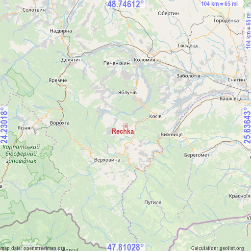
Rechka GPS coordinates[2]
48° 16' 49.224" North, 24° 55' 59.88" East
| Map corner | latitude | longitude |
|---|---|---|
| Upper-left | 48.74612°, | 24.23018° |
| Center: | 48.28034°, | 24.9333° |
| Lower-right: | 47.81028°, | 25.63643° |
| Map W x H: | 104.1×104.1 km | = 64.7×64.7mi |
| max Lat: | 52.18903° ⇑50.4% North |
| Rechka: | 48.28034° |
| min Lat: | ⇓49.6% South 44.39214° |
| min Long | Rechka | max Long |
| 22.20555° | 24.9333° | 40.13222° |
| W 13.6%⇐ | ⇒86.4% E |
Elevation
Elevation of Rechka is 550 m = 1804 ft, and this is 394.2 m = 1293 ft above average elevation for this country.
| Max E: |
886 m = 2907 ft | 1.2% |
| Rechka | 550 m 1804 ft | |
| Avg. | 155.8 m = 511 ft | |
Min E: |
-3 m = -10 ft | 98.8% |
See also: Ukraine elevation on elevation.city.
Geographical zone
Rechka is located in North temperate zone (between Tropic of Cancer and the Arctic Circle). Distance of this North polar circle is 2032.9 km =1263.2 mi to North.| Distance of | km | miles | from Rechka |
|---|---|---|---|
| North Pole | 4638.8 | 2882.4 | to North |
| Arctic Circle | 2032.9 | 1263.2 | to North |
| Tropic Cancer | 2762.4 | 1716.5 | to South |
| Equator | 5368.3 | 3335.7 | to South |


Nearby cities:
15 places around Rechka: (largest is in red/bold)
• Ispas
25.3 km =15.7 mi,  85°
85°
• Khymchyn
19.8 km =12.3 mi,  53°
53°
• Kosiv
12.5 km =7.8 mi,  74°
74°
• Kosmach
10 km =6.2 mi,  303°
303°
• Krivopol’ye
19.9 km =12.4 mi,  241°
241°
• Kuty
18.4 km =11.4 mi,  97°
97°
• Pechenizhyn
26.3 km =16.3 mi,  353°
353°
• Rozhniv
23.6 km =14.7 mi, 66°
• Sheshory
6.8 km =4.2 mi,  32°
32°
• Stari Kuty
17.8 km =11.1 mi, 93°
• Velykyy Klyuchiv
21.2 km =13.2 mi,  2°
2°
• Verkhniy Yasenov
13.2 km =8.2 mi,  176°
176°
• Verkhovyna
17.4 km =10.8 mi,  217°
217°
• Vyzhnytsya
19.7 km =12.2 mi, 100°
• Yabluniv
13.8 km =8.6 mi, 1°
Sources, notices
• [Note1] Compared only with cities in Ukraine existing in our database
• [Src1] Map data: © OpenStreetMap contributors (CC-BY-SA)
• [Src2] Other city data from geonames.org with taken over terms of usage.
• [Src3] Geographical zone / Annual Mean Temperature by Robert A. Rohde @ Wikipedia
