Volovets geodata
Volovets (Transcarpathia) is a populated place; located in Ukraine in Europe/Uzhgorod (GMT+3) time zone. With population of 5,177 people, there are 634 cities with bigger population in this country. Compared to other cities in Ukraine, 60.7% of cities are located further ↓South; 97.5% of cities are located further →East and 98.3% of cities have lower elevation than Volovets. Note1


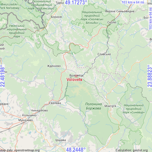
Volovets GPS coordinates[2]
48° 42' 39.24" North, 23° 11' 6.36" East
| Map corner | latitude | longitude |
|---|---|---|
| Upper-left | 49.17273°, | 22.48198° |
| Center: | 48.7109°, | 23.1851° |
| Lower-right: | 48.2448°, | 23.88823° |
| Map W x H: | 103.2×103.2 km | = 64.1×64.1mi |
| max Lat: | 52.18903° ⇑39.3% North |
| Volovets: | 48.7109° |
| min Lat: | ⇓60.7% South 44.39214° |
| min Long | Volovets | max Long |
| 22.20555° | 23.1851° | 40.13222° |
| W 2.5%⇐ | ⇒97.5% E |
Elevation
Elevation of Volovets is 529 m = 1736 ft, and this is 373.2 m = 1224 ft above average elevation for this country.
| Max E: |
886 m = 2907 ft | 1.7% |
| Volovets | 529 m 1736 ft | |
| Avg. | 155.8 m = 511 ft | |
Min E: |
-3 m = -10 ft | 98.3% |
See also: Ukraine elevation on elevation.city.
Geographical zone
Volovets is located in North temperate zone (between Tropic of Cancer and the Arctic Circle). Distance of this North polar circle is 1985 km =1233.4 mi to North.| Distance of | km | miles | from Volovets |
|---|---|---|---|
| North Pole | 4590.9 | 2852.7 | to North |
| Arctic Circle | 1985 | 1233.4 | to North |
| Tropic Cancer | 2810.2 | 1746.2 | to South |
| Equator | 5416.1 | 3365.4 | to South |


Nearby cities:
15 places around Volovets: (largest is in red/bold)
• Bereznyky
22 km =13.7 mi,  173°
173°
• Chynadiyovo
36.9 km =22.9 mi,  226°
226°
• Dovhe
39 km =24.2 mi, 169°
• Hrebeniv
35.6 km =22.1 mi,  37°
37°
• Kushnytsya
30.6 km =19 mi, 169°
• Lysychovo
25 km =15.5 mi,  162°
162°
• Mizhhirya
31.4 km =19.5 mi,  131°
131°
• Nelipyno
20.1 km =12.5 mi,  214°
214°
• Poroshkovo
32 km =19.9 mi,  261°
261°
• Pylypets
9.2 km =5.7 mi, 128°
• Slavske
24.4 km =15.2 mi,  51°
51°
• Svalyava
22.8 km =14.2 mi,  217°
217°
• Synevyrska Poliana
39.6 km =24.6 mi,  110°
110°
• Tukhlia
30.7 km =19.1 mi, 43°
• Verchnia Rozhanka
25.4 km =15.8 mi,  72°
72°
Sources, notices
• [Note1] Compared only with cities in Ukraine existing in our database
• [Src1] Map data: © OpenStreetMap contributors (CC-BY-SA)
• [Src2] Other city data from geonames.org with taken over terms of usage.
• [Src3] Geographical zone / Annual Mean Temperature by Robert A. Rohde @ Wikipedia
