Mizhhirya geodata
Mizhhirya (Transcarpathia) is a seat of a second-order administrative division; located in Ukraine in Europe/Uzhgorod (GMT+3) time zone. With population of 10,000 people, there are 360 cities with bigger population in this country. Compared to other cities in Ukraine, 56% of cities are located further ↓South; 95.7% of cities are located further →East and 97.6% of cities have lower elevation than Mizhhirya. Note1


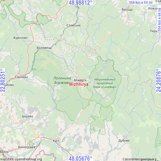
Mizhhirya GPS coordinates[2]
48° 31' 28.488" North, 23° 30' 20.268" East
| Map corner | latitude | longitude |
|---|---|---|
| Upper-left | 48.98812°, | 22.80251° |
| Center: | 48.52458°, | 23.50563° |
| Lower-right: | 48.05676°, | 24.20876° |
| Map W x H: | 103.6×103.6 km | = 64.4×64.4mi |
| max Lat: | 52.18903° ⇑44% North |
| Mizhhirya: | 48.52458° |
| min Lat: | ⇓56% South 44.39214° |
| min Long | Mizhhirya | max Long |
| 22.20555° | 23.50563° | 40.13222° |
| W 4.3%⇐ | ⇒95.7% E |
Elevation
Elevation of Mizhhirya is 452 m = 1483 ft, and this is 296.2 m = 972 ft above average elevation for this country.
| Max E: |
886 m = 2907 ft | 2.4% |
| Mizhhirya | 452 m 1483 ft | |
| Avg. | 155.8 m = 511 ft | |
Min E: |
-3 m = -10 ft | 97.6% |
See also: Ukraine elevation on elevation.city.
Geographical zone
Mizhhirya is located in North temperate zone (between Tropic of Cancer and the Arctic Circle). Distance of this North polar circle is 2005.7 km =1246.3 mi to North.| Distance of | km | miles | from Mizhhirya |
|---|---|---|---|
| North Pole | 4611.6 | 2865.5 | to North |
| Arctic Circle | 2005.7 | 1246.3 | to North |
| Tropic Cancer | 2789.5 | 1733.3 | to South |
| Equator | 5395.4 | 3352.5 | to South |


Nearby cities:
15 places around Mizhhirya: (largest is in red/bold)
• Bereznyky
21.1 km =13.1 mi,  266°
266°
• Berezovo
24 km =14.9 mi,  185°
185°
• Dovhe
24.4 km =15.2 mi,  223°
223°
• Drahovo
32.3 km =20.1 mi,  174°
174°
• Horinchovo
28.7 km =17.8 mi, 190°
• Kolochava
17.6 km =10.9 mi,  127°
127°
• Kopashnovo
33.9 km =21.1 mi,  182°
182°
• Kushnytsya
20.5 km =12.7 mi,  242°
242°
• Lypcha
30.7 km =19.1 mi,  197°
197°
• Lysychovo
16.2 km =10.1 mi,  258°
258°
• Pylypets
22.1 km =13.7 mi,  312°
312°
• Synevyr
9.8 km =6.1 mi,  115°
115°
• Synevyrska Poliana
15.1 km =9.4 mi,  63°
63°
• Verchnia Rozhanka
28.5 km =17.7 mi,  1°
1°
• Volovets
31.4 km =19.5 mi, 311°
Sources, notices
• [Note1] Compared only with cities in Ukraine existing in our database
• [Src1] Map data: © OpenStreetMap contributors (CC-BY-SA)
• [Src2] Other city data from geonames.org with taken over terms of usage.
• [Src3] Geographical zone / Annual Mean Temperature by Robert A. Rohde @ Wikipedia
