Bereznyky geodata
Bereznyky (Transcarpathia) is a populated place; located in Ukraine in Europe/Uzhgorod (GMT+3) time zone. With population of 3,055 people, there are 924 cities with bigger population in this country. Compared to other cities in Ukraine, 55.6% of cities are located further ↓South; 97.4% of cities are located further →East and 90.9% of cities have lower elevation than Bereznyky. Note1


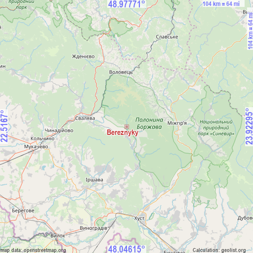
Bereznyky GPS coordinates[2]
48° 30' 50.652" North, 23° 13' 11.352" East
| Map corner | latitude | longitude |
|---|---|---|
| Upper-left | 48.97771°, | 22.5167° |
| Center: | 48.51407°, | 23.21982° |
| Lower-right: | 48.04615°, | 23.92295° |
| Map W x H: | 103.6×103.6 km | = 64.4×64.4mi |
| max Lat: | 52.18903° ⇑44.4% North |
| Bereznyky: | 48.51407° |
| min Lat: | ⇓55.6% South 44.39214° |
| min Long | Bereznyky | max Long |
| 22.20555° | 23.21982° | 40.13222° |
| W 2.6%⇐ | ⇒97.4% E |
Elevation
Elevation of Bereznyky is 313 m = 1027 ft, and this is 157.2 m = 516 ft above average elevation for this country.
| Max E: |
886 m = 2907 ft | 9.1% |
| Bereznyky | 313 m 1027 ft | |
| Avg. | 155.8 m = 511 ft | |
Min E: |
-3 m = -10 ft | 90.9% |
See also: Ukraine elevation on elevation.city.
Geographical zone
Bereznyky is located in North temperate zone (between Tropic of Cancer and the Arctic Circle). Distance of this North polar circle is 2006.9 km =1247 mi to North.| Distance of | km | miles | from Bereznyky |
|---|---|---|---|
| North Pole | 4612.8 | 2866.3 | to North |
| Arctic Circle | 2006.9 | 1247 | to North |
| Tropic Cancer | 2788.3 | 1732.6 | to South |
| Equator | 5394.3 | 3351.9 | to South |


Nearby cities:
15 places around Bereznyky: (largest is in red/bold)
• Berezovo
29.5 km =18.3 mi,  140°
140°
• Bilky
23.1 km =14.4 mi,  196°
196°
• Chynadiyovo
29.6 km =18.4 mi,  263°
263°
• Dovhe
17.1 km =10.6 mi,  165°
165°
• Horinchovo
31.4 km =19.5 mi,  149°
149°
• Irshava
25.7 km =16 mi,  211°
211°
• Kushnytsya
8.7 km =5.4 mi,  161°
161°
• Lypcha
30.6 km =19 mi, 156°
• Lysychovo
5.5 km =3.4 mi,  110°
110°
• Mizhhirya
21.1 km =13.1 mi,  86°
86°
• Nelipyno
14.8 km =9.2 mi,  290°
290°
• Pylypets
16.8 km =10.4 mi,  16°
16°
• Svalyava
16.9 km =10.5 mi,  283°
283°
• Synevyr
30.1 km =18.7 mi,  95°
95°
• Volovets
22 km =13.7 mi,  353°
353°
Sources, notices
• [Note1] Compared only with cities in Ukraine existing in our database
• [Src1] Map data: © OpenStreetMap contributors (CC-BY-SA)
• [Src2] Other city data from geonames.org with taken over terms of usage.
• [Src3] Geographical zone / Annual Mean Temperature by Robert A. Rohde @ Wikipedia
