Synevyrska Poliana geodata
Synevyrska Poliana (Transcarpathia) is a populated place; located in Ukraine in Europe/Uzhgorod (GMT+3) time zone. With population of 1,355 people, there are 1250 cities with bigger population in this country. Compared to other cities in Ukraine, 57.6% of cities are located further ↓South; 94.5% of cities are located further →East and 99.8% of cities have lower elevation than Synevyrska Poliana. Note1


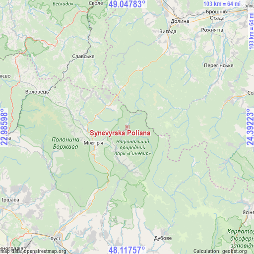
Synevyrska Poliana GPS coordinates[2]
48° 35' 5.424" North, 23° 41' 20.76" East
| Map corner | latitude | longitude |
|---|---|---|
| Upper-left | 49.04783°, | 22.98598° |
| Center: | 48.58484°, | 23.6891° |
| Lower-right: | 48.11757°, | 24.39223° |
| Map W x H: | 103.4×103.4 km | = 64.2×64.2mi |
| max Lat: | 52.18903° ⇑42.4% North |
| Synevyrska Poliana: | 48.58484° |
| min Lat: | ⇓57.6% South 44.39214° |
| min Long | Synevyrska Poli | max Long |
| 22.20555° | 23.6891° | 40.13222° |
| W 5.5%⇐ | ⇒94.5% E |
Elevation
Elevation of Synevyrska Poliana is 802 m = 2631 ft, and this is 646.2 m = 2120 ft above average elevation for this country.
| Max E: |
886 m = 2907 ft | 0.2% |
| Synevyrska Poliana | 802 m 2631 ft | |
| Avg. | 155.8 m = 511 ft | |
Min E: |
-3 m = -10 ft | 99.8% |
See also: Ukraine elevation on elevation.city.
Geographical zone
Synevyrska Poliana is located in North temperate zone (between Tropic of Cancer and the Arctic Circle). Distance of this North polar circle is 1999 km =1242.1 mi to North.| Distance of | km | miles | from Synevyrska Poliana |
|---|---|---|---|
| North Pole | 4604.9 | 2861.4 | to North |
| Arctic Circle | 1999 | 1242.1 | to North |
| Tropic Cancer | 2796.2 | 1737.5 | to South |
| Equator | 5402.1 | 3356.7 | to South |


Nearby cities:
15 places around Synevyrska Poliana: (largest is in red/bold)
• Bereznyky
35.4 km =22 mi,  257°
257°
• Berezovo
34.5 km =21.4 mi,  207°
207°
• Dovhe
38.9 km =24.2 mi,  231°
231°
• Horinchovo
39.6 km =24.6 mi, 208°
• Kolochava
17.4 km =10.8 mi,  178°
178°
• Kushnytsya
35.6 km =22.1 mi,  243°
243°
• Lopukhiv
31.7 km =19.7 mi,  140°
140°
• Lysychovo
31 km =19.3 mi,  251°
251°
• Mizhhirya
15.1 km =9.4 mi, 243°
• Pylypets
30.9 km =19.2 mi,  285°
285°
• Slavske
34.2 km =21.3 mi,  328°
328°
• Synevyr
11.8 km =7.3 mi,  203°
203°
• Tukhlia
39.7 km =24.7 mi,  336°
336°
• Verchnia Rozhanka
25.2 km =15.7 mi, 329°
• Volovets
39.6 km =24.6 mi, 290°
Sources, notices
• [Note1] Compared only with cities in Ukraine existing in our database
• [Src1] Map data: © OpenStreetMap contributors (CC-BY-SA)
• [Src2] Other city data from geonames.org with taken over terms of usage.
• [Src3] Geographical zone / Annual Mean Temperature by Robert A. Rohde @ Wikipedia
