Verkhnie Synevydne geodata
Verkhnie Synevydne (Lviv) is a populated place; located in Ukraine in Europe/Kiev (GMT+3) time zone. With population of 3,555 people, there are 821 cities with bigger population in this country. Compared to other cities in Ukraine, 68.4% of cities are located further ↓South; 94.9% of cities are located further →East and 95.7% of cities have lower elevation than Verkhnie Synevydne. Note1


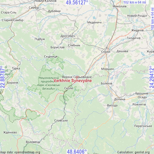
Verkhnie Synevydne GPS coordinates[2]
49° 6' 11.052" North, 23° 35' 27.564" East
| Map corner | latitude | longitude |
|---|---|---|
| Upper-left | 49.56127°, | 22.88787° |
| Center: | 49.10307°, | 23.59099° |
| Lower-right: | 48.6406°, | 24.29412° |
| Map W x H: | 102.4×102.4 km | = 63.6×63.6mi |
| max Lat: | 52.18903° ⇑31.6% North |
| Verkhnie Synevydne: | 49.10307° |
| min Lat: | ⇓68.4% South 44.39214° |
| min Long | Verkhnie Synevy | max Long |
| 22.20555° | 23.59099° | 40.13222° |
| W 5.1%⇐ | ⇒94.9% E |
Elevation
Elevation of Verkhnie Synevydne is 379 m = 1243 ft, and this is 223.2 m = 732 ft above average elevation for this country.
| Max E: |
886 m = 2907 ft | 4.3% |
| Verkhnie Synevydne | 379 m 1243 ft | |
| Avg. | 155.8 m = 511 ft | |
Min E: |
-3 m = -10 ft | 95.7% |
See also: Ukraine elevation on elevation.city.
Geographical zone
Verkhnie Synevydne is located in North temperate zone (between Tropic of Cancer and the Arctic Circle). Distance of this North polar circle is 1941.4 km =1206.3 mi to North.| Distance of | km | miles | from Verkhnie Synevydne |
|---|---|---|---|
| North Pole | 4547.3 | 2825.6 | to North |
| Arctic Circle | 1941.4 | 1206.3 | to North |
| Tropic Cancer | 2853.8 | 1773.3 | to South |
| Equator | 5459.7 | 3392.5 | to South |


Nearby cities:
15 places around Verkhnie Synevydne: (largest is in red/bold)
• Bolekhiv
20.3 km =12.6 mi,  101°
101°
• Boryslav
23.4 km =14.5 mi,  330°
330°
• Drohobych
28.1 km =17.5 mi,  347°
347°
• Duliby
21.7 km =13.5 mi,  48°
48°
• Hrebeniv
17.3 km =10.7 mi,  207°
207°
• Morshyn
21.3 km =13.2 mi,  73°
73°
• Skhidnytsya
22.4 km =13.9 mi,  308°
308°
• Skole
9.3 km =5.8 mi,  217°
217°
• Slavske
30.3 km =18.8 mi,  200°
200°
• Stebnyk
21.3 km =13.2 mi, 354°
• Stryi
26.2 km =16.3 mi, 47°
• Truskavets’
20.4 km =12.7 mi,  342°
342°
• Tukhlia
22.9 km =14.2 mi, 202°
• Ulychne
15.2 km =9.4 mi,  16°
16°
• Розгирче
7.4 km =4.6 mi, 72°
Sources, notices
• [Note1] Compared only with cities in Ukraine existing in our database
• [Src1] Map data: © OpenStreetMap contributors (CC-BY-SA)
• [Src2] Other city data from geonames.org with taken over terms of usage.
• [Src3] Geographical zone / Annual Mean Temperature by Robert A. Rohde @ Wikipedia
