Skole geodata
Skole (Lviv) is a seat of a second-order administrative division; located in Ukraine in Europe/Kiev (GMT+3) time zone. With population of 6,491 people, there are 540 cities with bigger population in this country. Compared to other cities in Ukraine, 67.3% of cities are located further ↓South; 95.6% of cities are located further →East and 97.3% of cities have lower elevation than Skole. Note1


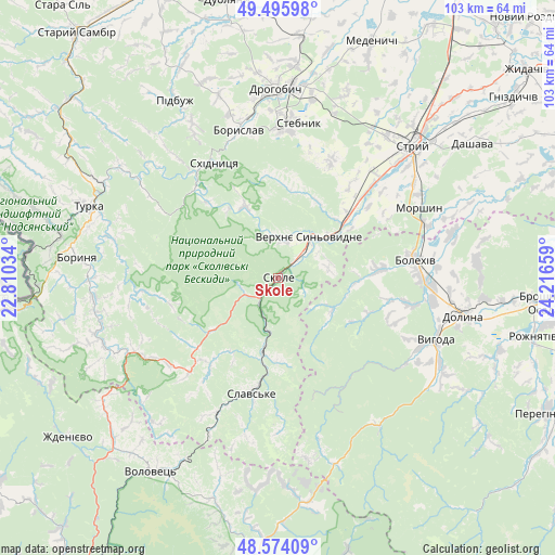
Skole GPS coordinates[2]
49° 2' 13.812" North, 23° 30' 48.456" East
| Map corner | latitude | longitude |
|---|---|---|
| Upper-left | 49.49598°, | 22.81034° |
| Center: | 49.03717°, | 23.51346° |
| Lower-right: | 48.57409°, | 24.21659° |
| Map W x H: | 102.5×102.5 km | = 63.7×63.7mi |
| max Lat: | 52.18903° ⇑32.7% North |
| Skole: | 49.03717° |
| min Lat: | ⇓67.3% South 44.39214° |
| min Long | Skole | max Long |
| 22.20555° | 23.51346° | 40.13222° |
| W 4.4%⇐ | ⇒95.6% E |
Elevation
Elevation of Skole is 439 m = 1440 ft, and this is 283.2 m = 929 ft above average elevation for this country.
| Max E: |
886 m = 2907 ft | 2.7% |
| Skole | 439 m 1440 ft | |
| Avg. | 155.8 m = 511 ft | |
Min E: |
-3 m = -10 ft | 97.3% |
See also: Ukraine elevation on elevation.city.
Geographical zone
Skole is located in North temperate zone (between Tropic of Cancer and the Arctic Circle). Distance of this North polar circle is 1948.8 km =1210.9 mi to North.| Distance of | km | miles | from Skole |
|---|---|---|---|
| North Pole | 4554.6 | 2830.1 | to North |
| Arctic Circle | 1948.8 | 1210.9 | to North |
| Tropic Cancer | 2846.5 | 1768.7 | to South |
| Equator | 5452.4 | 3388 | to South |


Nearby cities:
15 places around Skole: (largest is in red/bold)
• Bolekhiv
25.8 km =16 mi,  82°
82°
• Boryslav
28.4 km =17.6 mi,  348°
348°
• Drohobych
34.8 km =21.6 mi,  359°
359°
• Duliby
30.8 km =19.1 mi,  45°
45°
• Hrebeniv
8.3 km =5.2 mi,  196°
196°
• Morshyn
29.3 km =18.2 mi,  63°
63°
• Skhidnytsya
24.3 km =15.1 mi,  330°
330°
• Slavske
21.7 km =13.5 mi,  193°
193°
• Stebnyk
28.8 km =17.9 mi,  7°
7°
• Truskavets’
26.8 km =16.7 mi, 358°
• Tukhlia
14.2 km =8.8 mi, 191°
• Ulychne
24.1 km =15 mi,  24°
24°
• Verchnia Rozhanka
28.5 km =17.7 mi,  179°
179°
• Verkhnie Synevydne
9.3 km =5.8 mi,  37°
37°
• Розгирче
15.9 km =9.9 mi, 53°
Sources, notices
• [Note1] Compared only with cities in Ukraine existing in our database
• [Src1] Map data: © OpenStreetMap contributors (CC-BY-SA)
• [Src2] Other city data from geonames.org with taken over terms of usage.
• [Src3] Geographical zone / Annual Mean Temperature by Robert A. Rohde @ Wikipedia
