Tsarychanka geodata
Tsarychanka (Dnipropetrovsk) is a seat of a second-order administrative division; located in Ukraine in Europe/Kiev (GMT+3) time zone. With population of 7,638 people, there are 470 cities with bigger population in this country. Compared to other cities in Ukraine, 64.9% of cities are located further ↓South; 73.1% of cities are located further ←West and 72.8% of cities have higher elevation than Tsarychanka. Note1


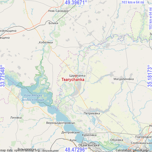
Tsarychanka GPS coordinates[2]
48° 56' 13.092" North, 34° 28' 42.96" East
| Map corner | latitude | longitude |
|---|---|---|
| Upper-left | 49.39671°, | 33.77548° |
| Center: | 48.93697°, | 34.4786° |
| Lower-right: | 48.47296°, | 35.18173° |
| Map W x H: | 102.7×102.7 km | = 63.8×63.8mi |
| max Lat: | 52.18903° ⇑35.1% North |
| Tsarychanka: | 48.93697° |
| min Lat: | ⇓64.9% South 44.39214° |
| min Long | Tsarychanka | max Long |
| 22.20555° | 34.4786° | 40.13222° |
| W 73.1%⇐ | ⇒26.9% E |
Elevation
Elevation of Tsarychanka is 68 m = 223 ft, and this is 87.8 m = 288 ft below average elevation for this country.
| Max E: |
886 m = 2907 ft | 72.8% |
| Avg. | 155.8 m = 511 ft | |
| Tsarychanka | 68 m = 223 ft | |
Min E: |
-3 m = -10 ft | 27.2% |
See also: Ukraine elevation on elevation.city.
Geographical zone
Tsarychanka is located in North temperate zone (between Tropic of Cancer and the Arctic Circle). Distance of this North polar circle is 1959.9 km =1217.8 mi to North.| Distance of | km | miles | from Tsarychanka |
|---|---|---|---|
| North Pole | 4565.8 | 2837.1 | to North |
| Arctic Circle | 1959.9 | 1217.8 | to North |
| Tropic Cancer | 2835.4 | 1761.8 | to South |
| Equator | 5441.3 | 3381.1 | to South |


Nearby cities:
15 places around Tsarychanka: (largest is in red/bold)
• Auly
41.2 km =25.6 mi,  181°
181°
• Hubynykha
58.6 km =36.4 mi,  103°
103°
• Hupalivka
27 km =16.8 mi,  44°
44°
• Kamianske
48.2 km =30 mi,  169°
169°
• Kobelyaky
31.3 km =19.4 mi,  318°
318°
• Kozel’shchyna
55.5 km =34.5 mi,  304°
304°
• Lutovynivka
53.5 km =33.2 mi,  308°
308°
• Lykhivka
49.3 km =30.6 mi,  235°
235°
• Mahdalynivka
31.9 km =19.8 mi,  93°
93°
• Novi Sanzhary
46.9 km =29.1 mi,  344°
344°
• Novomykolayivka
43 km =26.7 mi,  190°
190°
• Partyzans’ke
45.9 km =28.5 mi,  148°
148°
• Petrykivka
25.7 km =16 mi, 153°
• Spas’ke
51.8 km =32.2 mi,  125°
125°
• Verkhn’odniprovs’k
33.4 km =20.8 mi,  198°
198°
Sources, notices
• [Note1] Compared only with cities in Ukraine existing in our database
• [Src1] Map data: © OpenStreetMap contributors (CC-BY-SA)
• [Src2] Other city data from geonames.org with taken over terms of usage.
• [Src3] Geographical zone / Annual Mean Temperature by Robert A. Rohde @ Wikipedia
