Novi Sanzhary geodata
Novi Sanzhary (Poltava) is a seat of a second-order administrative division; located in Ukraine in Europe/Kiev (GMT+3) time zone. With population of 8,020 people, there are 441 cities with bigger population in this country. Compared to other cities in Ukraine, 71.6% of cities are located further ↓South; 69.7% of cities are located further ←West and 69.2% of cities have higher elevation than Novi Sanzhary. Note1


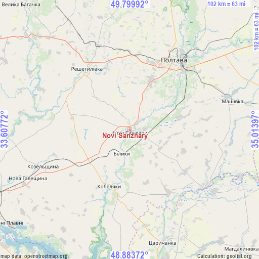
Novi Sanzhary GPS coordinates[2]
49° 20' 38.22" North, 34° 18' 39.024" East
| Map corner | latitude | longitude |
|---|---|---|
| Upper-left | 49.79992°, | 33.60772° |
| Center: | 49.34395°, | 34.31084° |
| Lower-right: | 48.88372°, | 35.01397° |
| Map W x H: | 101.9×101.9 km | = 63.3×63.3mi |
| max Lat: | 52.18903° ⇑28.4% North |
| Novi Sanzhary: | 49.34395° |
| min Lat: | ⇓71.6% South 44.39214° |
| min Long | Novi Sanzhary | max Long |
| 22.20555° | 34.31084° | 40.13222° |
| W 69.7%⇐ | ⇒30.3% E |
Elevation
Elevation of Novi Sanzhary is 77 m = 253 ft, and this is 78.8 m = 259 ft below average elevation for this country.
| Max E: |
886 m = 2907 ft | 69.2% |
| Avg. | 155.8 m = 511 ft | |
| Novi Sanzhary | 77 m = 253 ft | |
Min E: |
-3 m = -10 ft | 30.8% |
See also: Ukraine elevation on elevation.city.
Geographical zone
Novi Sanzhary is located in North temperate zone (between Tropic of Cancer and the Arctic Circle). Distance of this North polar circle is 1914.6 km =1189.7 mi to North.| Distance of | km | miles | from Novi Sanzhary |
|---|---|---|---|
| North Pole | 4520.5 | 2808.9 | to North |
| Arctic Circle | 1914.6 | 1189.7 | to North |
| Tropic Cancer | 2880.6 | 1789.9 | to South |
| Equator | 5486.5 | 3409.2 | to South |


Nearby cities:
15 places around Novi Sanzhary: (largest is in red/bold)
• Dykan’ka
55.7 km =34.6 mi,  16°
16°
• Horishni Plavni
61.5 km =38.2 mi,  232°
232°
• Hupalivka
40.2 km =25 mi,  129°
129°
• Karlivka
60.6 km =37.7 mi,  77°
77°
• Kobelyaky
23.2 km =14.4 mi,  200°
200°
• Kozel’shchyna
36.4 km =22.6 mi,  247°
247°
• Lutovynivka
31.7 km =19.7 mi, 248°
• Mahdalynivka
64.4 km =40 mi,  136°
136°
• Mashivka
41.7 km =25.9 mi,  74°
74°
• Poltava
32.4 km =20.1 mi,  30°
30°
• Reshetylivka
29.8 km =18.5 mi,  325°
325°
• Shyshaky
63.6 km =39.5 mi,  340°
340°
• Tsarychanka
46.9 km =29.1 mi,  164°
164°
• Varvarivka
67.9 km =42.2 mi, 71°
• Velyka Bahachka
65.4 km =40.6 mi,  319°
319°
Sources, notices
• [Note1] Compared only with cities in Ukraine existing in our database
• [Src1] Map data: © OpenStreetMap contributors (CC-BY-SA)
• [Src2] Other city data from geonames.org with taken over terms of usage.
• [Src3] Geographical zone / Annual Mean Temperature by Robert A. Rohde @ Wikipedia
