Kobelyaky geodata
Kobelyaky (Poltava) is a seat of a second-order administrative division; located in Ukraine in Europe/Kiev (GMT+3) time zone. With population of 11,692 people, there are 314 cities with bigger population in this country. Compared to other cities in Ukraine, 69% of cities are located further ↓South; 67.5% of cities are located further ←West and 67.7% of cities have higher elevation than Kobelyaky. Note1


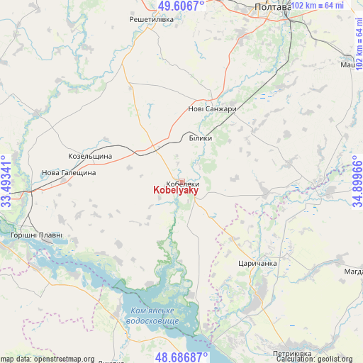
Kobelyaky GPS coordinates[2]
49° 8' 56.112" North, 34° 11' 47.508" East
| Map corner | latitude | longitude |
|---|---|---|
| Upper-left | 49.6067°, | 33.49341° |
| Center: | 49.14892°, | 34.19653° |
| Lower-right: | 48.68687°, | 34.89966° |
| Map W x H: | 102.3×102.3 km | = 63.6×63.6mi |
| max Lat: | 52.18903° ⇑31% North |
| Kobelyaky: | 49.14892° |
| min Lat: | ⇓69% South 44.39214° |
| min Long | Kobelyaky | max Long |
| 22.20555° | 34.19653° | 40.13222° |
| W 67.5%⇐ | ⇒32.5% E |
Elevation
Elevation of Kobelyaky is 82 m = 269 ft, and this is 73.8 m = 242 ft below average elevation for this country.
| Max E: |
886 m = 2907 ft | 67.7% |
| Avg. | 155.8 m = 511 ft | |
| Kobelyaky | 82 m = 269 ft | |
Min E: |
-3 m = -10 ft | 32.3% |
See also: Ukraine elevation on elevation.city.
Geographical zone
Kobelyaky is located in North temperate zone (between Tropic of Cancer and the Arctic Circle). Distance of this North polar circle is 1936.3 km =1203.2 mi to North.| Distance of | km | miles | from Kobelyaky |
|---|---|---|---|
| North Pole | 4542.2 | 2822.4 | to North |
| Arctic Circle | 1936.3 | 1203.2 | to North |
| Tropic Cancer | 2858.9 | 1776.4 | to South |
| Equator | 5464.8 | 3395.7 | to South |


Nearby cities:
15 places around Kobelyaky: (largest is in red/bold)
• Horishni Plavni
43.7 km =27.2 mi,  249°
249°
• Hupalivka
39.4 km =24.5 mi,  96°
96°
• Kamennyye Potoki
52.3 km =32.5 mi, 248°
• Kozel’shchyna
26.4 km =16.4 mi,  286°
286°
• Kremenchuk
57.2 km =35.5 mi,  260°
260°
• Lutovynivka
23.3 km =14.5 mi, 294°
• Lykhivka
55.1 km =34.2 mi,  201°
201°
• Mahdalynivka
58.2 km =36.2 mi,  115°
115°
• Mashivka
58.6 km =36.4 mi,  56°
56°
• Novi Sanzhary
23.2 km =14.4 mi,  20°
20°
• Petrykivka
56.5 km =35.1 mi,  145°
145°
• Poltava
55.4 km =34.4 mi,  26°
26°
• Reshetylivka
47.1 km =29.3 mi,  349°
349°
• Tsarychanka
31.3 km =19.4 mi,  138°
138°
• Verkhn’odniprovs’k
56.1 km =34.9 mi,  169°
169°
Sources, notices
• [Note1] Compared only with cities in Ukraine existing in our database
• [Src1] Map data: © OpenStreetMap contributors (CC-BY-SA)
• [Src2] Other city data from geonames.org with taken over terms of usage.
• [Src3] Geographical zone / Annual Mean Temperature by Robert A. Rohde @ Wikipedia
