Spas’ke geodata
Spas’ke (Dnipropetrovsk) is a populated place; located in Ukraine in Europe/Kiev (GMT+3) time zone. With population of 3,017 people, there are 939 cities with bigger population in this country. Compared to other cities in Ukraine, 59.5% of cities are located further ↓South; 80.7% of cities are located further ←West and 72.8% of cities have higher elevation than Spas’ke. Note1


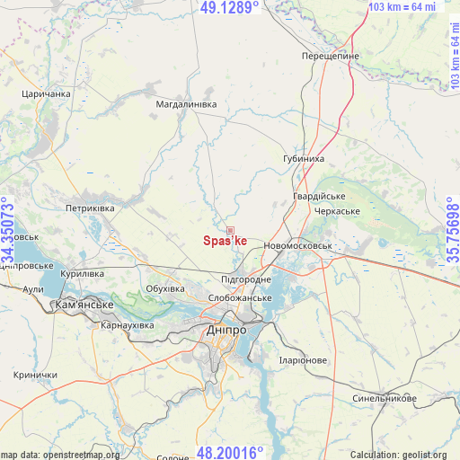
Spas’ke GPS coordinates[2]
48° 40' 0.012" North, 35° 3' 13.86" East
| Map corner | latitude | longitude |
|---|---|---|
| Upper-left | 49.1289°, | 34.35073° |
| Center: | 48.66667°, | 35.05385° |
| Lower-right: | 48.20016°, | 35.75698° |
| Map W x H: | 103.3×103.3 km | = 64.2×64.2mi |
| max Lat: | 52.18903° ⇑40.5% North |
| Spas’ke: | 48.66667° |
| min Lat: | ⇓59.5% South 44.39214° |
| min Long | Spas’ke | max Long |
| 22.20555° | 35.05385° | 40.13222° |
| W 80.7%⇐ | ⇒19.3% E |
Elevation
Elevation of Spas’ke is 68 m = 223 ft, and this is 87.8 m = 288 ft below average elevation for this country.
| Max E: |
886 m = 2907 ft | 72.8% |
| Avg. | 155.8 m = 511 ft | |
| Spas’ke | 68 m = 223 ft | |
Min E: |
-3 m = -10 ft | 27.2% |
See also: Ukraine elevation on elevation.city.
Geographical zone
Spas’ke is located in North temperate zone (between Tropic of Cancer and the Arctic Circle). Distance of this North polar circle is 1989.9 km =1236.5 mi to North.| Distance of | km | miles | from Spas’ke |
|---|---|---|---|
| North Pole | 4595.8 | 2855.7 | to North |
| Arctic Circle | 1989.9 | 1236.5 | to North |
| Tropic Cancer | 2805.3 | 1743.1 | to South |
| Equator | 5411.2 | 3362.4 | to South |


Nearby cities:
15 places around Spas’ke: (largest is in red/bold)
• Auly
45 km =28 mi,  255°
255°
• Aviatorske
33.4 km =20.8 mi,  176°
176°
• Dnipro
23.1 km =14.4 mi, 182°
• Hubynykha
21.7 km =13.5 mi,  42°
42°
• Kamianske
37.4 km =23.2 mi,  242°
242°
• Kaydaki
32.6 km =20.3 mi,  170°
170°
• Khashchevoye
21.4 km =13.3 mi,  79°
79°
• Mahdalynivka
30.1 km =18.7 mi,  340°
340°
• Melioratyvne
26.9 km =16.7 mi,  98°
98°
• Novomoskovs’k
14.4 km =8.9 mi, 102°
• Partyzans’ke
20 km =12.4 mi, 243°
• Petrykivka
31.6 km =19.6 mi,  282°
282°
• Pidhorodne
10.9 km =6.8 mi,  159°
159°
• Surs’ko-Mykhaylivka
50 km =31.1 mi,  208°
208°
• Synel’nykove
51.5 km =32 mi,  138°
138°
Sources, notices
• [Note1] Compared only with cities in Ukraine existing in our database
• [Src1] Map data: © OpenStreetMap contributors (CC-BY-SA)
• [Src2] Other city data from geonames.org with taken over terms of usage.
• [Src3] Geographical zone / Annual Mean Temperature by Robert A. Rohde @ Wikipedia
