Stizhkivs’ke geodata
Stizhkivs’ke (Donetsk) is a populated place; located in Ukraine in Europe/Kiev (GMT+3) time zone. With population of 4,480 people, there are 703 cities with bigger population in this country. Compared to other cities in Ukraine, 54.6% of cities are located further ↑North; 96.7% of cities are located further ←West and 81.7% of cities have lower elevation than Stizhkivs’ke. Note1


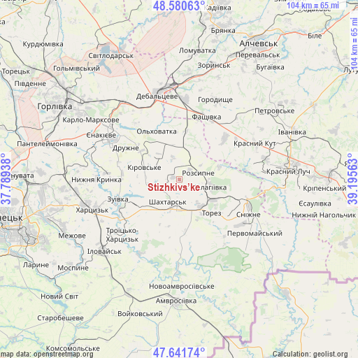
Stizhkivs’ke GPS coordinates[2]
48° 6' 47.988" North, 38° 29' 33" East
| Map corner | latitude | longitude |
|---|---|---|
| Upper-left | 48.58063°, | 37.78938° |
| Center: | 48.11333°, | 38.4925° |
| Lower-right: | 47.64174°, | 39.19563° |
| Map W x H: | 104.4×104.4 km | = 64.9×64.9mi |
| max Lat: | 52.18903° ⇑54.6% North |
| Stizhkivs’ke: | 48.11333° |
| min Lat: | ⇓45.4% South 44.39214° |
| min Long | Stizhkivs’ke | max Long |
| 22.20555° | 38.4925° | 40.13222° |
| W 96.7%⇐ | ⇒3.3% E |
Elevation
Elevation of Stizhkivs’ke is 257 m = 843 ft, and this is 101.2 m = 332 ft above average elevation for this country.
| Max E: |
886 m = 2907 ft | 18.3% |
| Stizhkivs’ke | 257 m 843 ft | |
| Avg. | 155.8 m = 511 ft | |
Min E: |
-3 m = -10 ft | 81.7% |
See also: Ukraine elevation on elevation.city.
Geographical zone
Stizhkivs’ke is located in North temperate zone (between Tropic of Cancer and the Arctic Circle). Distance of this North polar circle is 2051.5 km =1274.7 mi to North.| Distance of | km | miles | from Stizhkivs’ke |
|---|---|---|---|
| North Pole | 4657.4 | 2894 | to North |
| Arctic Circle | 2051.5 | 1274.7 | to North |
| Tropic Cancer | 2743.8 | 1704.9 | to South |
| Equator | 5349.7 | 3324.1 | to South |


Nearby cities:
15 places around Stizhkivs’ke: (largest is in red/bold)
• Blahodatne
26 km =16.2 mi,  181°
181°
• Chornukhyne
23.5 km =14.6 mi,  5°
5°
• Chystyakove
11.4 km =7.1 mi,  136°
136°
• Debal’tseve
26.1 km =16.2 mi,  345°
345°
• Krasnyy Kut
24.7 km =15.3 mi,  66°
66°
• Krasnyy Oktyabr’
26.5 km =16.5 mi,  305°
305°
• Nyzhnya Krynka
24.6 km =15.3 mi,  270°
270°
• Rozsypne
7.4 km =4.6 mi,  56°
56°
• Shakhtars’k
7.5 km =4.7 mi,  212°
212°
• Shakhtne
21.3 km =13.2 mi,  227°
227°
• Shyroke
26 km =16.2 mi, 228°
• Snizhne
22.9 km =14.2 mi,  115°
115°
• Yenakiyeve
24.7 km =15.3 mi,  302°
302°
• Zalesnoye
25.3 km =15.7 mi,  111°
111°
• Zuhres
20.4 km =12.7 mi,  236°
236°
Sources, notices
• [Note1] Compared only with cities in Ukraine existing in our database
• [Src1] Map data: © OpenStreetMap contributors (CC-BY-SA)
• [Src2] Other city data from geonames.org with taken over terms of usage.
• [Src3] Geographical zone / Annual Mean Temperature by Robert A. Rohde @ Wikipedia
