Debal’tseve geodata
Debal’tseve (Donetsk) is a populated place; located in Ukraine in Europe/Kiev (GMT+3) time zone. With population of 30,200 people, there are 141 cities with bigger population in this country. Compared to other cities in Ukraine, 51.1% of cities are located further ↓South; 96.4% of cities are located further ←West and 92.2% of cities have lower elevation than Debal’tseve. Note1


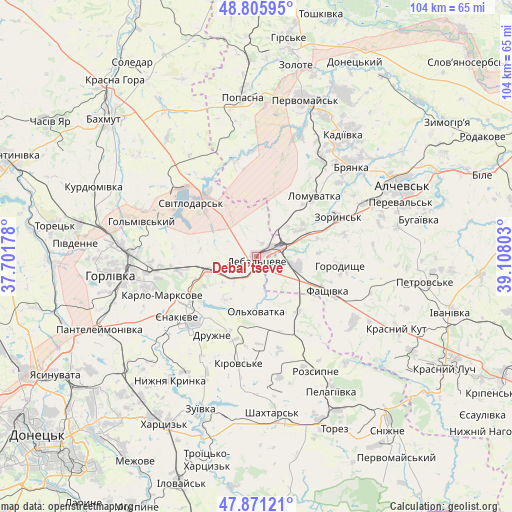
Debal’tseve GPS coordinates[2]
48° 20' 26.592" North, 38° 24' 17.64" East
| Map corner | latitude | longitude |
|---|---|---|
| Upper-left | 48.80595°, | 37.70178° |
| Center: | 48.34072°, | 38.4049° |
| Lower-right: | 47.87121°, | 39.10803° |
| Map W x H: | 103.9×103.9 km | = 64.6×64.6mi |
| max Lat: | 52.18903° ⇑48.9% North |
| Debal’tseve: | 48.34072° |
| min Lat: | ⇓51.1% South 44.39214° |
| min Long | Debal’tseve | max Long |
| 22.20555° | 38.4049° | 40.13222° |
| W 96.4%⇐ | ⇒3.6% E |
Elevation
Elevation of Debal’tseve is 323 m = 1060 ft, and this is 167.2 m = 549 ft above average elevation for this country.
| Max E: |
886 m = 2907 ft | 7.8% |
| Debal’tseve | 323 m 1060 ft | |
| Avg. | 155.8 m = 511 ft | |
Min E: |
-3 m = -10 ft | 92.2% |
See also: Ukraine elevation on elevation.city.
Geographical zone
Debal’tseve is located in North temperate zone (between Tropic of Cancer and the Arctic Circle). Distance of this North polar circle is 2026.2 km =1259 mi to North.| Distance of | km | miles | from Debal’tseve |
|---|---|---|---|
| North Pole | 4632.1 | 2878.3 | to North |
| Arctic Circle | 2026.2 | 1259 | to North |
| Tropic Cancer | 2769.1 | 1720.6 | to South |
| Equator | 5375 | 3339.9 | to South |


Nearby cities:
15 places around Debal’tseve: (largest is in red/bold)
• Artemivs’k
26.6 km =16.5 mi,  65°
65°
• Bayrachky
15.6 km =9.7 mi, 68°
• Bryanka
27.3 km =17 mi,  46°
46°
• Chornukhyne
8.9 km =5.5 mi,  102°
102°
• Horlivka
26 km =16.2 mi,  268°
268°
• Kadiyivka
30.8 km =19.1 mi,  34°
34°
• Krasnyy Oktyabr’
18.2 km =11.3 mi,  236°
236°
• Luhans’ke
15.8 km =9.8 mi,  317°
317°
• Nyzhnya Krynka
31.1 km =19.3 mi,  215°
215°
• Rozsypne
24.7 km =15.3 mi,  149°
149°
• Stizhkivs’ke
26.1 km =16.2 mi,  165°
165°
• Svetlodarsk
16.9 km =10.5 mi,  307°
307°
• Vuhlehirs’k
10.1 km =6.3 mi,  253°
253°
• Yenakiyeve
18.6 km =11.6 mi,  230°
230°
• Zoryns’k
18 km =11.2 mi,  63°
63°
Sources, notices
• [Note1] Compared only with cities in Ukraine existing in our database
• [Src1] Map data: © OpenStreetMap contributors (CC-BY-SA)
• [Src2] Other city data from geonames.org with taken over terms of usage.
• [Src3] Geographical zone / Annual Mean Temperature by Robert A. Rohde @ Wikipedia
