Stara Syniava geodata
Stara Syniava (Khmelnytskyi) is a seat of a second-order administrative division; located in Ukraine in Europe/Kiev (GMT+3) time zone. With population of 5,771 people, there are 580 cities with bigger population in this country. Compared to other cities in Ukraine, 76.3% of cities are located further ↓South; 76.9% of cities are located further →East and 87.7% of cities have lower elevation than Stara Syniava. Note1


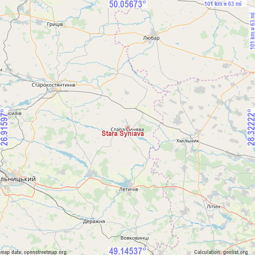
Stara Syniava GPS coordinates[2]
49° 36' 11.448" North, 27° 37' 8.724" East
| Map corner | latitude | longitude |
|---|---|---|
| Upper-left | 50.05673°, | 26.91597° |
| Center: | 49.60318°, | 27.61909° |
| Lower-right: | 49.14537°, | 28.32222° |
| Map W x H: | 101.3×101.3 km | = 62.9×62.9mi |
| max Lat: | 52.18903° ⇑23.7% North |
| Stara Syniava: | 49.60318° |
| min Lat: | ⇓76.3% South 44.39214° |
| min Long | Stara Syniava | max Long |
| 22.20555° | 27.61909° | 40.13222° |
| W 23.1%⇐ | ⇒76.9% E |
Elevation
Elevation of Stara Syniava is 292 m = 958 ft, and this is 136.2 m = 447 ft above average elevation for this country.
| Max E: |
886 m = 2907 ft | 12.3% |
| Stara Syniava | 292 m 958 ft | |
| Avg. | 155.8 m = 511 ft | |
Min E: |
-3 m = -10 ft | 87.7% |
See also: Ukraine elevation on elevation.city.
Geographical zone
Stara Syniava is located in North temperate zone (between Tropic of Cancer and the Arctic Circle). Distance of this North polar circle is 1885.8 km =1171.8 mi to North.| Distance of | km | miles | from Stara Syniava |
|---|---|---|---|
| North Pole | 4491.7 | 2791 | to North |
| Arctic Circle | 1885.8 | 1171.8 | to North |
| Tropic Cancer | 2909.4 | 1807.8 | to South |
| Equator | 5515.4 | 3427.1 | to South |


Nearby cities:
15 places around Stara Syniava: (largest is in red/bold)
• Antoniny
58.1 km =36.1 mi,  293°
293°
• Bar
58.7 km =36.5 mi,  175°
175°
• Derazhnya
39.5 km =24.5 mi,  199°
199°
• Khmelnytskyi
49.3 km =30.6 mi,  245°
245°
• Khmilnyk
24.9 km =15.5 mi,  101°
101°
• Krasyliv
46.9 km =29.1 mi,  276°
276°
• Letychiv
24.5 km =15.2 mi, 178°
• Lityn
45.5 km =28.3 mi,  132°
132°
• Liubar
36.7 km =22.8 mi,  15°
15°
• Medzhybizh
24.1 km =15 mi,  220°
220°
• Novoselytsya
52.4 km =32.6 mi,  352°
352°
• Polonne
58.5 km =36.4 mi, 352°
• Starokostiantyniv
34.5 km =21.4 mi,  299°
299°
• Suslivtsi
18.5 km =11.5 mi,  173°
173°
• Ulaniv
38.4 km =23.9 mi,  74°
74°
Sources, notices
• [Note1] Compared only with cities in Ukraine existing in our database
• [Src1] Map data: © OpenStreetMap contributors (CC-BY-SA)
• [Src2] Other city data from geonames.org with taken over terms of usage.
• [Src3] Geographical zone / Annual Mean Temperature by Robert A. Rohde @ Wikipedia
