Dnipro geodata
Dnipro (Dnipropetrovsk) is a seat of a first-order administrative division; located in Ukraine in Europe/Kiev (GMT+3) time zone. With population of 1,032,822 people, there are 2 cities with bigger population in this country. Compared to other cities in Ukraine, 54.4% of cities are located further ↓South; 80.7% of cities are located further ←West and 62.1% of cities have higher elevation than Dnipro. Note1


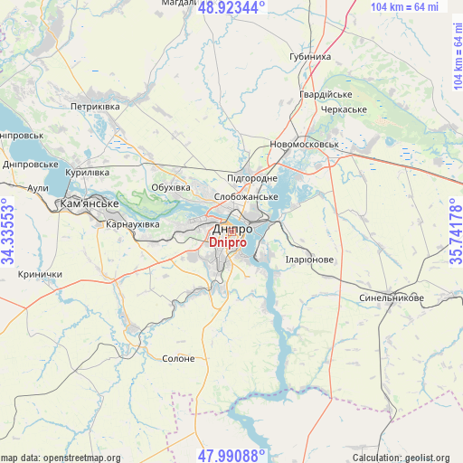
Dnipro GPS coordinates[2]
48° 27' 33.48" North, 35° 2' 19.14" East
| Map corner | latitude | longitude |
|---|---|---|
| Upper-left | 48.92344°, | 34.33553° |
| Center: | 48.4593°, | 35.03865° |
| Lower-right: | 47.99088°, | 35.74178° |
| Map W x H: | 103.7×103.7 km | = 64.4×64.4mi |
| max Lat: | 52.18903° ⇑45.6% North |
| Dnipro: | 48.4593° |
| min Lat: | ⇓54.4% South 44.39214° |
| min Long | Dnipro | max Long |
| 22.20555° | 35.03865° | 40.13222° |
| W 80.7%⇐ | ⇒19.3% E |
Elevation
Elevation of Dnipro is 100 m = 328 ft, and this is 55.8 m = 183 ft below average elevation for this country.
| Max E: |
886 m = 2907 ft | 62.1% |
| Avg. | 155.8 m = 511 ft | |
| Dnipro | 100 m = 328 ft | |
Min E: |
-3 m = -10 ft | 37.9% |
See also: Dnipro elevation on elevation.city.
Geographical zone
Dnipro is located in North temperate zone (between Tropic of Cancer and the Arctic Circle). Distance of this North polar circle is 2013 km =1250.8 mi to North.| Distance of | km | miles | from Dnipro |
|---|---|---|---|
| North Pole | 4618.9 | 2870.1 | to North |
| Arctic Circle | 2013 | 1250.8 | to North |
| Tropic Cancer | 2782.3 | 1728.8 | to South |
| Equator | 5388.2 | 3348.1 | to South |


Nearby cities:
15 places around Dnipro: (largest is in red/bold)
• Aviatorske
10.7 km =6.6 mi,  162°
162°
• Hubynykha
42.1 km =26.2 mi,  22°
22°
• Kamianske
32.7 km =20.3 mi,  280°
280°
• Kaydaki
11.1 km =6.9 mi,  145°
145°
• Khashchevoye
34.9 km =21.7 mi,  39°
39°
• Krynychky
43.2 km =26.8 mi,  257°
257°
• Melioratyvne
33.6 km =20.9 mi,  55°
55°
• Novomoskovs’k
25 km =15.5 mi, 37°
• Partyzans’ke
22 km =13.7 mi,  310°
310°
• Petrykivka
42.3 km =26.3 mi,  315°
315°
• Pidhorodne
13.8 km =8.6 mi, 21°
• Solone
30.5 km =19 mi,  203°
203°
• Spas’ke
23.1 km =14.4 mi,  2°
2°
• Surs’ko-Mykhaylivka
31 km =19.3 mi,  227°
227°
• Synel’nykove
38.6 km =24 mi,  113°
113°
In other languages:
- In Spanish: Dnipró
- In Italian: Dnipropetrovs'k
- In Russian: Днепр, Екатеринослав, Днепропетровск, Jekatierinosław, Noworossijsk, Екатериносла́въ
- In Chinese: 第聂伯罗彼得罗夫斯克, 聶伯城
Sources, notices
• [Note1] Compared only with cities in Ukraine existing in our database
• [Src1] Map data: © OpenStreetMap contributors (CC-BY-SA)
• [Src2] Other city data from geonames.org with taken over terms of usage.
• [Src3] Geographical zone / Annual Mean Temperature by Robert A. Rohde @ Wikipedia
