Sholokhove geodata
Sholokhove (Dnipropetrovsk) is a populated place; located in Ukraine in Europe/Kiev (GMT+3) time zone. With population of 3,097 people, there are 911 cities with bigger population in this country. Compared to other cities in Ukraine, 59.2% of cities are located further ↑North; 63.6% of cities are located further ←West and 84.3% of cities have higher elevation than Sholokhove. Note1


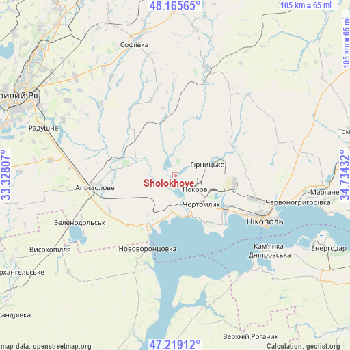
Sholokhove GPS coordinates[2]
47° 41' 40.308" North, 34° 1' 52.284" East
| Map corner | latitude | longitude |
|---|---|---|
| Upper-left | 48.16565°, | 33.32807° |
| Center: | 47.69453°, | 34.03119° |
| Lower-right: | 47.21912°, | 34.73432° |
| Map W x H: | 105.2×105.2 km | = 65.4×65.4mi |
| max Lat: | 52.18903° ⇑59.2% North |
| Sholokhove: | 47.69453° |
| min Lat: | ⇓40.8% South 44.39214° |
| min Long | Sholokhove | max Long |
| 22.20555° | 34.03119° | 40.13222° |
| W 63.6%⇐ | ⇒36.4% E |
Elevation
Elevation of Sholokhove is 31 m = 102 ft, and this is 124.8 m = 409 ft below average elevation for this country.
| Max E: |
886 m = 2907 ft | 84.3% |
| Avg. | 155.8 m = 511 ft | |
| Sholokhove | 31 m = 102 ft | |
Min E: |
-3 m = -10 ft | 15.7% |
See also: Ukraine elevation on elevation.city.
Geographical zone
Sholokhove is located in North temperate zone (between Tropic of Cancer and the Arctic Circle). Distance of this North polar circle is 2098 km =1303.6 mi to North.| Distance of | km | miles | from Sholokhove |
|---|---|---|---|
| North Pole | 4703.9 | 2922.9 | to North |
| Arctic Circle | 2098 | 1303.6 | to North |
| Tropic Cancer | 2697.2 | 1676 | to South |
| Equator | 5303.1 | 3295.2 | to South |


Nearby cities:
15 places around Sholokhove: (largest is in red/bold)
• Apostolove
24.1 km =15 mi,  260°
260°
• Chervonohryhorivka
38.8 km =24.1 mi,  101°
101°
• Chortomlyk
11.5 km =7.1 mi,  133°
133°
• Dniprovka
53 km =32.9 mi,  123°
123°
• Energodar
51.8 km =32.2 mi,  114°
114°
• Kamenka-Na-Dnepre
36.8 km =22.9 mi, 129°
• Kryvyi Rih
54.2 km =33.7 mi,  296°
296°
• Marhanets’
45.1 km =28 mi, 98°
• Nikopol
30.6 km =19 mi, 116°
• Novovorontsovka
23.2 km =14.4 mi,  201°
201°
• Ordzhonikidze
3.7 km =2.3 mi,  144°
144°
• Sofiyivka
41 km =25.5 mi,  343°
343°
• Verkhniy Rohachyk
54.5 km =33.9 mi,  154°
154°
• Vodyane
41.5 km =25.8 mi, 123°
• Vysokopillya
43.8 km =27.2 mi,  239°
239°
Sources, notices
• [Note1] Compared only with cities in Ukraine existing in our database
• [Src1] Map data: © OpenStreetMap contributors (CC-BY-SA)
• [Src2] Other city data from geonames.org with taken over terms of usage.
• [Src3] Geographical zone / Annual Mean Temperature by Robert A. Rohde @ Wikipedia
