Rozhniativ geodata
Rozhniativ (Ivano-Frankivsk) is a seat of a second-order administrative division; located in Ukraine in Europe/Kiev (GMT+3) time zone. With population of 3,983 people, there are 767 cities with bigger population in this country. Compared to other cities in Ukraine, 64.8% of cities are located further ↓South; 91.8% of cities are located further →East and 95% of cities have lower elevation than Rozhniativ. Note1


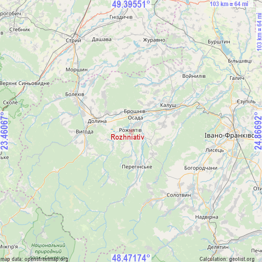
Rozhniativ GPS coordinates[2]
48° 56' 8.736" North, 24° 9' 49.644" East
| Map corner | latitude | longitude |
|---|---|---|
| Upper-left | 49.39551°, | 23.46067° |
| Center: | 48.93576°, | 24.16379° |
| Lower-right: | 48.47174°, | 24.86692° |
| Map W x H: | 102.7×102.7 km | = 63.8×63.8mi |
| max Lat: | 52.18903° ⇑35.2% North |
| Rozhniativ: | 48.93576° |
| min Lat: | ⇓64.8% South 44.39214° |
| min Long | Rozhniativ | max Long |
| 22.20555° | 24.16379° | 40.13222° |
| W 8.2%⇐ | ⇒91.8% E |
Elevation
Elevation of Rozhniativ is 362 m = 1188 ft, and this is 206.2 m = 677 ft above average elevation for this country.
| Max E: |
886 m = 2907 ft | 5% |
| Rozhniativ | 362 m 1188 ft | |
| Avg. | 155.8 m = 511 ft | |
Min E: |
-3 m = -10 ft | 95% |
See also: Ukraine elevation on elevation.city.
Geographical zone
Rozhniativ is located in North temperate zone (between Tropic of Cancer and the Arctic Circle). Distance of this North polar circle is 1960 km =1217.9 mi to North.| Distance of | km | miles | from Rozhniativ |
|---|---|---|---|
| North Pole | 4565.9 | 2837.1 | to North |
| Arctic Circle | 1960 | 1217.9 | to North |
| Tropic Cancer | 2835.2 | 1761.7 | to South |
| Equator | 5441.1 | 3380.9 | to South |


Nearby cities:
15 places around Rozhniativ: (largest is in red/bold)
• Bohorodchany
30.9 km =19.2 mi,  117°
117°
• Bolekhiv
26.2 km =16.3 mi,  303°
303°
• Broshniv-Osada
7.2 km =4.5 mi,  20°
20°
• Dolyna
12 km =7.5 mi,  290°
290°
• Kalush
17.5 km =10.9 mi,  61°
61°
• Kosmach
25.4 km =15.8 mi,  144°
144°
• Morshyn
32.5 km =20.2 mi,  319°
319°
• Nebyliv
13.9 km =8.6 mi,  163°
163°
• Novytsya
12.9 km =8 mi,  76°
76°
• Petranka
10.9 km =6.8 mi,  109°
109°
• Porohy
28.5 km =17.7 mi,  165°
165°
• Solotvyn
32.1 km =19.9 mi, 143°
• Spas
9 km =5.6 mi,  235°
235°
• Stari Bohorodchany
28.7 km =17.8 mi, 113°
• Svarychiv
3.8 km =2.4 mi,  39°
39°
Sources, notices
• [Note1] Compared only with cities in Ukraine existing in our database
• [Src1] Map data: © OpenStreetMap contributors (CC-BY-SA)
• [Src2] Other city data from geonames.org with taken over terms of usage.
• [Src3] Geographical zone / Annual Mean Temperature by Robert A. Rohde @ Wikipedia
