Broshniv-Osada geodata
Broshniv-Osada (Ivano-Frankivsk) is a populated place; located in Ukraine in Europe/Kiev (GMT+3) time zone. With population of 5,548 people, there are 602 cities with bigger population in this country. Compared to other cities in Ukraine, 66.2% of cities are located further ↓South; 91.6% of cities are located further →East and 94.2% of cities have lower elevation than Broshniv-Osada. Note1


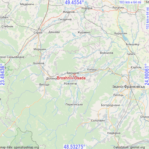
Broshniv-Osada GPS coordinates[2]
48° 59' 46.356" North, 24° 11' 50.928" East
| Map corner | latitude | longitude |
|---|---|---|
| Upper-left | 49.4554°, | 23.49436° |
| Center: | 48.99621°, | 24.19748° |
| Lower-right: | 48.53275°, | 24.90061° |
| Map W x H: | 102.6×102.6 km | = 63.8×63.8mi |
| max Lat: | 52.18903° ⇑33.8% North |
| Broshniv-Osada: | 48.99621° |
| min Lat: | ⇓66.2% South 44.39214° |
| min Long | Broshniv-Osada | max Long |
| 22.20555° | 24.19748° | 40.13222° |
| W 8.4%⇐ | ⇒91.6% E |
Elevation
Elevation of Broshniv-Osada is 349 m = 1145 ft, and this is 193.2 m = 634 ft above average elevation for this country.
| Max E: |
886 m = 2907 ft | 5.8% |
| Broshniv-Osada | 349 m 1145 ft | |
| Avg. | 155.8 m = 511 ft | |
Min E: |
-3 m = -10 ft | 94.2% |
See also: Ukraine elevation on elevation.city.
Geographical zone
Broshniv-Osada is located in North temperate zone (between Tropic of Cancer and the Arctic Circle). Distance of this North polar circle is 1953.3 km =1213.7 mi to North.| Distance of | km | miles | from Broshniv-Osada |
|---|---|---|---|
| North Pole | 4559.2 | 2833 | to North |
| Arctic Circle | 1953.3 | 1213.7 | to North |
| Tropic Cancer | 2841.9 | 1765.9 | to South |
| Equator | 5447.9 | 3385.2 | to South |


Nearby cities:
15 places around Broshniv-Osada: (largest is in red/bold)
• Bohorodchany
32.6 km =20.3 mi,  130°
130°
• Bolekhiv
25.5 km =15.8 mi,  287°
287°
• Dolyna
14 km =8.7 mi,  259°
259°
• Kalush
12.9 km =8 mi,  82°
82°
• Kosmach
30 km =18.6 mi,  155°
155°
• Morshyn
29.6 km =18.4 mi,  306°
306°
• Nebyliv
20.2 km =12.6 mi,  176°
176°
• Novytsya
10.7 km =6.6 mi,  109°
109°
• Petranka
13 km =8.1 mi,  143°
143°
• Porohy
34.7 km =21.6 mi,  172°
172°
• Rozhniativ
7.2 km =4.5 mi,  200°
200°
• Spas
15.4 km =9.6 mi,  219°
219°
• Stari Bohorodchany
30 km =18.6 mi, 127°
• Svarychiv
3.8 km =2.4 mi, 180°
• Zahvizdya
34.3 km =21.3 mi,  104°
104°
Sources, notices
• [Note1] Compared only with cities in Ukraine existing in our database
• [Src1] Map data: © OpenStreetMap contributors (CC-BY-SA)
• [Src2] Other city data from geonames.org with taken over terms of usage.
• [Src3] Geographical zone / Annual Mean Temperature by Robert A. Rohde @ Wikipedia
