Chudey geodata
Chudey (Chernivtsi Oblast') is a populated place; located in Ukraine in Europe/Kiev (GMT+3) time zone. With population of 5,058 people, there are 645 cities with bigger population in this country. Compared to other cities in Ukraine, 55.6% of cities are located further ↑North; 83% of cities are located further →East and 96.1% of cities have lower elevation than Chudey. Note1


Chudey GPS coordinates[2]
48° 3' 8.892" North, 25° 37' 19.488" East
| Map corner | latitude | longitude |
|---|---|---|
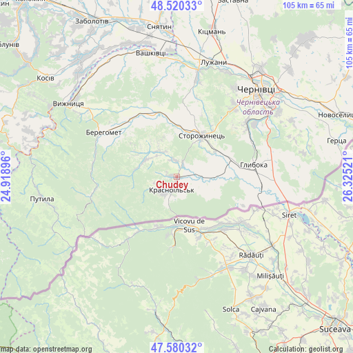
| Upper-left | 48.52033°, | 24.91896° |
| Center: | 48.05247°, | 25.62208° |
| Lower-right: | 47.58032°, | 26.32521° |
| Map W x H: | 104.5×104.5 km | = 64.9×64.9mi |
| max Lat: | 52.18903° ⇑55.6% North |
| Chudey: | 48.05247° |
| min Lat: | ⇓44.4% South 44.39214° |
| min Long | Chudey | max Long |
| 22.20555° | 25.62208° | 40.13222° |
| W 17%⇐ | ⇒83% E |
Elevation
Elevation of Chudey is 387 m = 1270 ft, and this is 231.2 m = 759 ft above average elevation for this country.
| Max E: |
886 m = 2907 ft | 3.9% |
| Chudey | 387 m 1270 ft | |
| Avg. | 155.8 m = 511 ft | |
Min E: |
-3 m = -10 ft | 96.1% |
See also: Ukraine elevation on elevation.city.
Geographical zone
Chudey is located in North temperate zone (between Tropic of Cancer and the Arctic Circle). Distance of this North polar circle is 2058.2 km =1278.9 mi to North.| Distance of | km | miles | from Chudey |
|---|---|---|---|
| North Pole | 4664.1 | 2898.1 | to North |
| Arctic Circle | 2058.2 | 1278.9 | to North |
| Tropic Cancer | 2737 | 1700.7 | to South |
| Equator | 5342.9 | 3319.9 | to South |


Nearby cities:
15 places around Chudey: (largest is in red/bold)
• Berehomet
24.7 km =15.3 mi,  304°
304°
• Chernivtsi
35.5 km =22.1 mi,  41°
41°
• Davydivka
8.7 km =5.4 mi,  330°
330°
• Hlyboka
23.2 km =14.4 mi,  79°
79°
• Ispas
37.5 km =23.3 mi,  316°
316°
• Luzhany
36.5 km =22.7 mi,  17°
17°
• Molodiya
35.2 km =21.9 mi,  57°
57°
• Myhove
21.5 km =13.4 mi, 302°
• Nyzhni Petrivtsi
8 km =5 mi,  109°
109°
• Ropcha
13.6 km =8.5 mi, 56°
• Shypyntsi
37.2 km =23.1 mi,  14°
14°
• Storozhynets’
14.4 km =8.9 mi,  30°
30°
• Vashkivtsi
37.9 km =23.5 mi,  347°
347°
• Voloka
27.7 km =17.2 mi, 55°
• Yizhivtsi
3.3 km =2.1 mi,  115°
115°
Sources, notices
• [Note1] Compared only with cities in Ukraine existing in our database
• [Src1] Map data: © OpenStreetMap contributors (CC-BY-SA)
• [Src2] Other city data from geonames.org with taken over terms of usage.
• [Src3] Geographical zone / Annual Mean Temperature by Robert A. Rohde @ Wikipedia
