Krasnoarmeyskoye geodata
Krasnoarmeyskoye (Republic of Crimea) is a seat of a third-order administrative division; located in Ukraine in Europe/Simferopol (GMT+3) time zone. With population of 765 people, there are 1505 cities with bigger population in this country. Compared to other cities in Ukraine, 69.9% of cities are located further ↑North; 63.5% of cities are located further ←West and 99.5% of cities have higher elevation than Krasnoarmeyskoye. Note1
Administrative division(s):
- Level 1: Republic of Crimea
- Level 2: Krasnoperekopsk Raion
- Level 3: Krasnoarmeyskoye sel'skoye poselenye


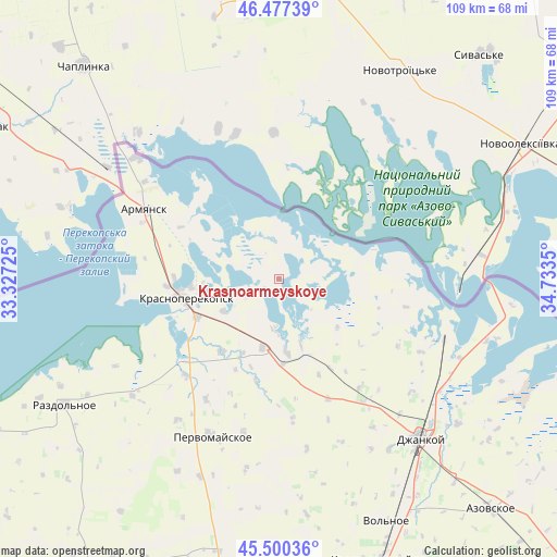
Krasnoarmeyskoye GPS coordinates[2]
45° 59' 27.708" North, 34° 1' 49.332" East
| Map corner | latitude | longitude |
|---|---|---|
| Upper-left | 46.47739°, | 33.32725° |
| Center: | 45.99103°, | 34.03037° |
| Lower-right: | 45.50036°, | 34.7335° |
| Map W x H: | 108.6×108.6 km | = 67.5×67.5mi |
| max Lat: | 52.18903° ⇑69.9% North |
| Krasnoarmeyskoye: | 45.99103° |
| min Lat: | ⇓30.1% South 44.39214° |
| min Long | Krasnoarmeyskoy | max Long |
| 22.20555° | 34.03037° | 40.13222° |
| W 63.5%⇐ | ⇒36.5% E |
Elevation
Elevation of Krasnoarmeyskoye is 3 m = 10 ft, and this is 152.8 m = 501 ft below average elevation for this country.
| Max E: |
886 m = 2907 ft | 99.5% |
| Avg. | 155.8 m = 511 ft | |
| Krasnoarmeyskoye | 3 m = 10 ft | |
Min E: |
-3 m = -10 ft | 0.5% |
See also: Ukraine elevation on elevation.city.
Geographical zone
Krasnoarmeyskoye is located in North temperate zone (between Tropic of Cancer and the Arctic Circle). Distance of this North polar circle is 2287.5 km =1421.4 mi to North.| Distance of | km | miles | from Krasnoarmeyskoye |
|---|---|---|---|
| North Pole | 4893.3 | 3040.6 | to North |
| Arctic Circle | 2287.5 | 1421.4 | to North |
| Tropic Cancer | 2507.8 | 1558.3 | to South |
| Equator | 5113.7 | 3177.5 | to South |


Nearby cities:
15 places around Krasnoarmeyskoye: (largest is in red/bold)
• Bratskoye
19.6 km =12.2 mi,  205°
205°
• Dolinka
15.9 km =9.9 mi, 205°
• Ishun’
17.6 km =10.9 mi,  245°
245°
• Istochnoye
9.4 km =5.8 mi,  182°
182°
• Krasnoperekops’k
18.5 km =11.5 mi,  258°
258°
• Magazinka
14.3 km =8.9 mi,  174°
174°
• Novoivanovka
16.9 km =10.5 mi, 176°
• Novopavlovka
17.6 km =10.9 mi,  218°
218°
• Pakharevka
20.1 km =12.5 mi,  149°
149°
• Pochetnoye
20.4 km =12.7 mi,  271°
271°
• Sovkhoznoye
20.3 km =12.6 mi, 260°
• Tselinnoye
15 km =9.3 mi,  129°
129°
• Vishnyovka
6.9 km =4.3 mi,  239°
239°
• Voinka
13.8 km =8.6 mi,  192°
192°
• Zelyonaya Niva
12.4 km =7.7 mi, 239°
Sources, notices
• [Note1] Compared only with cities in Ukraine existing in our database
• [Src1] Map data: © OpenStreetMap contributors (CC-BY-SA)
• [Src2] Other city data from geonames.org with taken over terms of usage.
• [Src3] Geographical zone / Annual Mean Temperature by Robert A. Rohde @ Wikipedia
