Kel’mentsi geodata
Kel’mentsi (Chernivtsi Oblast') is a seat of a second-order administrative division; located in Ukraine in Europe/Kiev (GMT+3) time zone. In our database, there are 1661 cities with bigger population. Compared to other cities in Ukraine, 54.6% of cities are located further ↓South; 78.4% of cities are located further →East and 69.8% of cities have lower elevation than Kel’mentsi. Note1


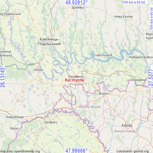
Kel’mentsi GPS coordinates[2]
48° 27' 54.108" North, 26° 50' 4.452" East
| Map corner | latitude | longitude |
|---|---|---|
| Upper-left | 48.92912°, | 26.13145° |
| Center: | 48.46503°, | 26.83457° |
| Lower-right: | 47.99666°, | 27.5377° |
| Map W x H: | 103.7×103.7 km | = 64.4×64.4mi |
| max Lat: | 52.18903° ⇑45.4% North |
| Kel’mentsi: | 48.46503° |
| min Lat: | ⇓54.6% South 44.39214° |
| min Long | Kel’mentsi | max Long |
| 22.20555° | 26.83457° | 40.13222° |
| W 21.6%⇐ | ⇒78.4% E |
Elevation
Elevation of Kel’mentsi is 205 m = 673 ft, and this is 49.2 m = 161 ft above average elevation for this country.
| Max E: |
886 m = 2907 ft | 30.2% |
| Kel’mentsi | 205 m 673 ft | |
| Avg. | 155.8 m = 511 ft | |
Min E: |
-3 m = -10 ft | 69.8% |
See also: Ukraine elevation on elevation.city.
Geographical zone
Kel’mentsi is located in North temperate zone (between Tropic of Cancer and the Arctic Circle). Distance of this North polar circle is 2012.4 km =1250.4 mi to North.| Distance of | km | miles | from Kel’mentsi |
|---|---|---|---|
| North Pole | 4618.3 | 2869.7 | to North |
| Arctic Circle | 2012.4 | 1250.4 | to North |
| Tropic Cancer | 2782.9 | 1729.2 | to South |
| Equator | 5388.8 | 3348.4 | to South |


Nearby cities:
15 places around Kel’mentsi: (largest is in red/bold)
• Boyany
56.6 km =35.2 mi,  247°
247°
• Dunaivtsi
47.2 km =29.3 mi,  1°
1°
• Dunayivtsi
61.8 km =38.4 mi, 0°
• Kamianets-Podilskyi
30.5 km =19 mi,  323°
323°
• Khotyn
25.7 km =16 mi,  280°
280°
• Klishkivtsi
42.4 km =26.3 mi,  264°
264°
• Makiv
38.1 km =23.7 mi,  344°
344°
• Marshintsy
48.7 km =30.3 mi,  235°
235°
• Murovani Kurylivtsi
58 km =36 mi,  60°
60°
• Nova Ushytsya
52.5 km =32.6 mi,  37°
37°
• Novodnistrovs’k
46.5 km =28.9 mi,  73°
73°
• Novoselytsya
50.2 km =31.2 mi, 236°
• Smotrych
29.7 km =18.5 mi, 317°
• Sokyryany
43 km =26.7 mi,  92°
92°
• Zhvanets
27.2 km =16.9 mi,  290°
290°
Sources, notices
• [Note1] Compared only with cities in Ukraine existing in our database
• [Src1] Map data: © OpenStreetMap contributors (CC-BY-SA)
• [Src2] Other city data from geonames.org with taken over terms of usage.
• [Src3] Geographical zone / Annual Mean Temperature by Robert A. Rohde @ Wikipedia
