Dunaivtsi geodata
Dunaivtsi (Khmelnytskyi) is a populated place; located in Ukraine in Europe/Kiev (GMT+3) time zone. With population of 15,836 people, there are 245 cities with bigger population in this country. Compared to other cities in Ukraine, 63.7% of cities are located further ↓South; 78.3% of cities are located further →East and 91.9% of cities have lower elevation than Dunaivtsi. Note1


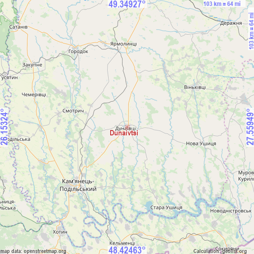
Dunaivtsi GPS coordinates[2]
48° 53' 20.724" North, 26° 51' 22.896" East
| Map corner | latitude | longitude |
|---|---|---|
| Upper-left | 49.34927°, | 26.15324° |
| Center: | 48.88909°, | 26.85636° |
| Lower-right: | 48.42463°, | 27.55949° |
| Map W x H: | 102.8×102.8 km | = 63.9×63.9mi |
| max Lat: | 52.18903° ⇑36.3% North |
| Dunaivtsi: | 48.88909° |
| min Lat: | ⇓63.7% South 44.39214° |
| min Long | Dunaivtsi | max Long |
| 22.20555° | 26.85636° | 40.13222° |
| W 21.7%⇐ | ⇒78.3% E |
Elevation
Elevation of Dunaivtsi is 320 m = 1050 ft, and this is 164.2 m = 539 ft above average elevation for this country.
| Max E: |
886 m = 2907 ft | 8.1% |
| Dunaivtsi | 320 m 1050 ft | |
| Avg. | 155.8 m = 511 ft | |
Min E: |
-3 m = -10 ft | 91.9% |
See also: Ukraine elevation on elevation.city.
Geographical zone
Dunaivtsi is located in North temperate zone (between Tropic of Cancer and the Arctic Circle). Distance of this North polar circle is 1965.2 km =1221.1 mi to North.| Distance of | km | miles | from Dunaivtsi |
|---|---|---|---|
| North Pole | 4571.1 | 2840.3 | to North |
| Arctic Circle | 1965.2 | 1221.1 | to North |
| Tropic Cancer | 2830 | 1758.5 | to South |
| Equator | 5436 | 3377.8 | to South |


Nearby cities:
15 places around Dunaivtsi: (largest is in red/bold)
• Chemerivtsi
40 km =24.9 mi,  289°
289°
• Dunayivtsi
14.7 km =9.1 mi,  355°
355°
• Horodok
36.4 km =22.6 mi,  326°
326°
• Kamianets-Podilskyi
30.2 km =18.8 mi,  221°
221°
• Kel’mentsi
47.2 km =29.3 mi,  181°
181°
• Khotyn
50.2 km =31.2 mi,  212°
212°
• Makiv
16 km =9.9 mi,  228°
228°
• Nova Ushytsya
31.1 km =19.3 mi,  100°
100°
• Novoye Sëlo
32 km =19.9 mi,  352°
352°
• Skala-Podil’s’ka
48.3 km =30 mi,  265°
265°
• Smotrych
33.3 km =20.7 mi, 220°
• Vinkivtsi
32.1 km =19.9 mi,  59°
59°
• Yarmolyntsi
33.7 km =20.9 mi, 357°
• Zakupne
45.7 km =28.4 mi,  304°
304°
• Zhvanets
46.4 km =28.8 mi, 215°
In other languages:
- In France: Dounaïvtsi
- In German: Dunajiwzi
- In Russian: Дунаевцы
- In Chinese: 杜納伊夫齊
Sources, notices
• [Note1] Compared only with cities in Ukraine existing in our database
• [Src1] Map data: © OpenStreetMap contributors (CC-BY-SA)
• [Src2] Other city data from geonames.org with taken over terms of usage.
• [Src3] Geographical zone / Annual Mean Temperature by Robert A. Rohde @ Wikipedia
