Khotyn geodata
Khotyn (Chernivtsi Oblast') is a seat of a second-order administrative division; located in Ukraine in Europe/Kiev (GMT+3) time zone. With population of 10,799 people, there are 334 cities with bigger population in this country. Compared to other cities in Ukraine, 55.3% of cities are located further ↓South; 79.2% of cities are located further →East and 79.6% of cities have lower elevation than Khotyn. Note1


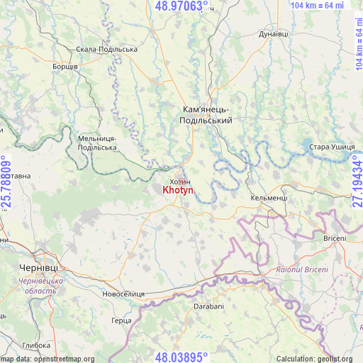
Khotyn GPS coordinates[2]
48° 30' 24.948" North, 26° 29' 28.356" East
| Map corner | latitude | longitude |
|---|---|---|
| Upper-left | 48.97063°, | 25.78809° |
| Center: | 48.50693°, | 26.49121° |
| Lower-right: | 48.03895°, | 27.19434° |
| Map W x H: | 103.6×103.6 km | = 64.4×64.4mi |
| max Lat: | 52.18903° ⇑44.7% North |
| Khotyn: | 48.50693° |
| min Lat: | ⇓55.3% South 44.39214° |
| min Long | Khotyn | max Long |
| 22.20555° | 26.49121° | 40.13222° |
| W 20.8%⇐ | ⇒79.2% E |
Elevation
Elevation of Khotyn is 244 m = 801 ft, and this is 88.2 m = 289 ft above average elevation for this country.
| Max E: |
886 m = 2907 ft | 20.4% |
| Khotyn | 244 m 801 ft | |
| Avg. | 155.8 m = 511 ft | |
Min E: |
-3 m = -10 ft | 79.6% |
See also: Ukraine elevation on elevation.city.
Geographical zone
Khotyn is located in North temperate zone (between Tropic of Cancer and the Arctic Circle). Distance of this North polar circle is 2007.7 km =1247.5 mi to North.| Distance of | km | miles | from Khotyn |
|---|---|---|---|
| North Pole | 4613.6 | 2866.8 | to North |
| Arctic Circle | 2007.7 | 1247.5 | to North |
| Tropic Cancer | 2787.5 | 1732.1 | to South |
| Equator | 5393.5 | 3351.4 | to South |


Nearby cities:
15 places around Khotyn: (largest is in red/bold)
• Borshchiv
46.6 km =29 mi,  315°
315°
• Boyany
37.6 km =23.4 mi,  225°
225°
• Chernivtsi
47.2 km =29.3 mi,  239°
239°
• Dunaivtsi
50.2 km =31.2 mi,  32°
32°
• Kamianets-Podilskyi
20.9 km =13 mi,  19°
19°
• Kel’mentsi
25.7 km =16 mi,  100°
100°
• Klishkivtsi
18.8 km =11.7 mi, 243°
• Makiv
35.2 km =21.9 mi, 24°
• Marshintsy
35.4 km =22 mi,  204°
204°
• Molodiya
46.9 km =29.1 mi, 227°
• Novoselytsya
36.1 km =22.4 mi,  207°
207°
• Skala-Podil’s’ka
43.9 km =27.3 mi,  330°
330°
• Smotrych
17.9 km =11.1 mi, 16°
• Zastavna
47.7 km =29.6 mi,  272°
272°
• Zhvanets
4.8 km =3 mi,  356°
356°
Sources, notices
• [Note1] Compared only with cities in Ukraine existing in our database
• [Src1] Map data: © OpenStreetMap contributors (CC-BY-SA)
• [Src2] Other city data from geonames.org with taken over terms of usage.
• [Src3] Geographical zone / Annual Mean Temperature by Robert A. Rohde @ Wikipedia
