Myronivka geodata
Myronivka (Kyiv) is a populated place; located in Ukraine in Europe/Kiev (GMT+3) time zone. With population of 12,871 people, there are 287 cities with bigger population in this country. Compared to other cities in Ukraine, 77.2% of cities are located further ↓South; 61.2% of cities are located further →East and 54% of cities have higher elevation than Myronivka. Note1


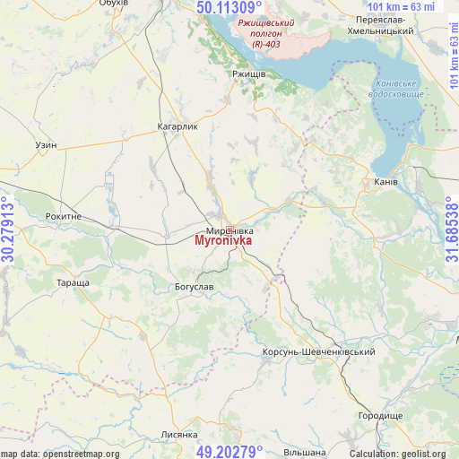
Myronivka GPS coordinates[2]
49° 39' 36.252" North, 30° 58' 56.1" East
| Map corner | latitude | longitude |
|---|---|---|
| Upper-left | 50.11309°, | 30.27913° |
| Center: | 49.66007°, | 30.98225° |
| Lower-right: | 49.20279°, | 31.68538° |
| Map W x H: | 101.2×101.2 km | = 62.9×62.9mi |
| max Lat: | 52.18903° ⇑22.8% North |
| Myronivka: | 49.66007° |
| min Lat: | ⇓77.2% South 44.39214° |
| min Long | Myronivka | max Long |
| 22.20555° | 30.98225° | 40.13222° |
| W 38.8%⇐ | ⇒61.2% E |
Elevation
Elevation of Myronivka is 122 m = 400 ft, and this is 33.8 m = 111 ft below average elevation for this country.
| Max E: |
886 m = 2907 ft | 54% |
| Avg. | 155.8 m = 511 ft | |
| Myronivka | 122 m = 400 ft | |
Min E: |
-3 m = -10 ft | 46% |
See also: Ukraine elevation on elevation.city.
Geographical zone
Myronivka is located in North temperate zone (between Tropic of Cancer and the Arctic Circle). Distance of this North polar circle is 1879.5 km =1167.9 mi to North.| Distance of | km | miles | from Myronivka |
|---|---|---|---|
| North Pole | 4485.4 | 2787.1 | to North |
| Arctic Circle | 1879.5 | 1167.9 | to North |
| Tropic Cancer | 2915.8 | 1811.8 | to South |
| Equator | 5521.7 | 3431 | to South |


Nearby cities:
15 places around Myronivka: (largest is in red/bold)
• Bohuslav
14.6 km =9.1 mi,  212°
212°
• Kaharlyk
25.1 km =15.6 mi,  333°
333°
• Kalynove
49.3 km =30.6 mi,  231°
231°
• Kaniv
35.8 km =22.2 mi,  73°
73°
• Karapyshi
14 km =8.7 mi,  261°
261°
• Korsun-Shevchenkivskyi
33.4 km =20.8 mi,  143°
143°
• Lysianka
46.7 km =29 mi,  193°
193°
• Mirovka
39.7 km =24.7 mi,  319°
319°
• Rokytne
36.7 km =22.8 mi,  274°
274°
• Rzhyshchiv
34.6 km =21.5 mi,  7°
7°
• Stayki
46.8 km =29.1 mi,  353°
353°
• Stebliv
29.9 km =18.6 mi,  163°
163°
• Tarashcha
37 km =23 mi,  252°
252°
• Uzyn
44.8 km =27.8 mi,  294°
294°
• Vytachiv
51.2 km =31.8 mi, 350°
Sources, notices
• [Note1] Compared only with cities in Ukraine existing in our database
• [Src1] Map data: © OpenStreetMap contributors (CC-BY-SA)
• [Src2] Other city data from geonames.org with taken over terms of usage.
• [Src3] Geographical zone / Annual Mean Temperature by Robert A. Rohde @ Wikipedia
