Dzvinogrud geodata
Dzvinogrud (Lviv) is a populated place; located in Ukraine in Europe/Kiev (GMT+3) time zone. With population of 1,200 people, there are 1297 cities with bigger population in this country. Compared to other cities in Ukraine, 78.6% of cities are located further ↓South; 91.1% of cities are located further →East and 79.8% of cities have lower elevation than Dzvinogrud. Note1


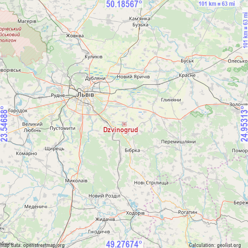
Dzvinogrud GPS coordinates[2]
49° 43' 59.988" North, 24° 15' 0" East
| Map corner | latitude | longitude |
|---|---|---|
| Upper-left | 50.18567°, | 23.54688° |
| Center: | 49.73333°, | 24.25° |
| Lower-right: | 49.27674°, | 24.95313° |
| Map W x H: | 101.1×101.1 km | = 62.8×62.8mi |
| max Lat: | 52.18903° ⇑21.4% North |
| Dzvinogrud: | 49.73333° |
| min Lat: | ⇓78.6% South 44.39214° |
| min Long | Dzvinogrud | max Long |
| 22.20555° | 24.25° | 40.13222° |
| W 8.9%⇐ | ⇒91.1% E |
Elevation
Elevation of Dzvinogrud is 245 m = 804 ft, and this is 89.2 m = 293 ft above average elevation for this country.
| Max E: |
886 m = 2907 ft | 20.2% |
| Dzvinogrud | 245 m 804 ft | |
| Avg. | 155.8 m = 511 ft | |
Min E: |
-3 m = -10 ft | 79.8% |
See also: Ukraine elevation on elevation.city.
Geographical zone
Dzvinogrud is located in North temperate zone (between Tropic of Cancer and the Arctic Circle). Distance of this North polar circle is 1871.3 km =1162.8 mi to North.| Distance of | km | miles | from Dzvinogrud |
|---|---|---|---|
| North Pole | 4477.2 | 2782 | to North |
| Arctic Circle | 1871.3 | 1162.8 | to North |
| Tropic Cancer | 2923.9 | 1816.8 | to South |
| Equator | 5529.8 | 3436.1 | to South |


Nearby cities:
15 places around Dzvinogrud: (largest is in red/bold)
• Bibrka
10.6 km =6.6 mi,  164°
164°
• Dublyany
22.3 km =13.9 mi,  328°
328°
• Godovytsya
24.2 km =15 mi,  278°
278°
• Lviv
20 km =12.4 mi,  305°
305°
• Navaria
23.2 km =14.4 mi,  274°
274°
• Novi Strilyscha
26.6 km =16.5 mi, 155°
• Novyi Yarychiv
19.4 km =12.1 mi,  11°
11°
• Peremyshlyany
23.4 km =14.5 mi,  108°
108°
• Pustomyty
24.3 km =15.1 mi, 265°
• Rudne
27.5 km =17.1 mi,  293°
293°
• Shpyl’chyna
8.1 km =5 mi, 163°
• Solonka
17.4 km =10.8 mi, 278°
• Staroye Selo
5 km =3.1 mi,  239°
239°
• Svirzh
16.6 km =10.3 mi,  124°
124°
• Verkhnyaya Belka
9.9 km =6.2 mi,  22°
22°
Sources, notices
• [Note1] Compared only with cities in Ukraine existing in our database
• [Src1] Map data: © OpenStreetMap contributors (CC-BY-SA)
• [Src2] Other city data from geonames.org with taken over terms of usage.
• [Src3] Geographical zone / Annual Mean Temperature by Robert A. Rohde @ Wikipedia
