Kostyantynivka geodata
Kostyantynivka (Donetsk) is a seat of a second-order administrative division; located in Ukraine in Europe/Kiev (GMT+3) time zone. With population of 91,259 people, there are 48 cities with bigger population in this country. Compared to other cities in Ukraine, 56.1% of cities are located further ↓South; 93.4% of cities are located further ←West and 65.8% of cities have higher elevation than Kostyantynivka. Note1


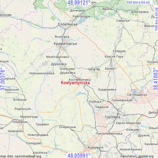
Kostyantynivka GPS coordinates[2]
48° 31' 39.72" North, 37° 42' 24.84" East
| Map corner | latitude | longitude |
|---|---|---|
| Upper-left | 48.99121°, | 37.00378° |
| Center: | 48.5277°, | 37.7069° |
| Lower-right: | 48.05991°, | 38.41003° |
| Map W x H: | 103.6×103.5 km | = 64.4×64.3mi |
| max Lat: | 52.18903° ⇑43.9% North |
| Kostyantynivka: | 48.5277° |
| min Lat: | ⇓56.1% South 44.39214° |
| min Long | Kostyantynivka | max Long |
| 22.20555° | 37.7069° | 40.13222° |
| W 93.4%⇐ | ⇒6.6% E |
Elevation
Elevation of Kostyantynivka is 87 m = 285 ft, and this is 68.8 m = 226 ft below average elevation for this country.
| Max E: |
886 m = 2907 ft | 65.8% |
| Avg. | 155.8 m = 511 ft | |
| Kostyantynivka | 87 m = 285 ft | |
Min E: |
-3 m = -10 ft | 34.2% |
See also: Kostyantynivka elevation on elevation.city.
Geographical zone
Kostyantynivka is located in North temperate zone (between Tropic of Cancer and the Arctic Circle). Distance of this North polar circle is 2005.4 km =1246.1 mi to North.| Distance of | km | miles | from Kostyantynivka |
|---|---|---|---|
| North Pole | 4611.3 | 2865.3 | to North |
| Arctic Circle | 2005.4 | 1246.1 | to North |
| Tropic Cancer | 2789.9 | 1733.6 | to South |
| Equator | 5395.8 | 3352.8 | to South |


Nearby cities:
15 places around Kostyantynivka: (largest is in red/bold)
• Bakhmut
22.8 km =14.2 mi,  70°
70°
• Bilyts’ke
41 km =25.5 mi,  250°
250°
• Chasiv Yar
13.3 km =8.3 mi,  56°
56°
• Druzhkivka
16.1 km =10 mi,  315°
315°
• Horlivka
33.3 km =20.7 mi,  129°
129°
• Kramators’k
24.4 km =15.2 mi,  332°
332°
• Krasnotorka
21.4 km =13.3 mi, 323°
• Kryva Luka
41.1 km =25.5 mi,  20°
20°
• Myrnohrad
41.2 km =25.6 mi,  233°
233°
• Rodyns’ke
41.8 km =26 mi,  242°
242°
• Shcherbynivka
16 km =9.9 mi,  157°
157°
• Sloviansk
38.3 km =23.8 mi,  350°
350°
• Soledar
32.8 km =20.4 mi, 59°
• Svetlodarsk
39.5 km =24.5 mi,  105°
105°
• Toretsk
17.7 km =11 mi,  144°
144°
Sources, notices
• [Note1] Compared only with cities in Ukraine existing in our database
• [Src1] Map data: © OpenStreetMap contributors (CC-BY-SA)
• [Src2] Other city data from geonames.org with taken over terms of usage.
• [Src3] Geographical zone / Annual Mean Temperature by Robert A. Rohde @ Wikipedia
