Druzhba geodata
Druzhba (Ternopil) is a populated place; located in Ukraine in Europe/Kiev (GMT+3) time zone. With population of 1,586 people, there are 1194 cities with bigger population in this country. Compared to other cities in Ukraine, 67.5% of cities are located further ↓South; 83.8% of cities are located further →East and 93% of cities have lower elevation than Druzhba. Note1


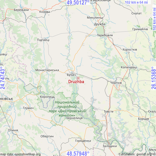
Druzhba GPS coordinates[2]
49° 2' 33.036" North, 25° 27' 1.98" East
| Map corner | latitude | longitude |
|---|---|---|
| Upper-left | 49.50127°, | 24.74743° |
| Center: | 49.04251°, | 25.45055° |
| Lower-right: | 48.57948°, | 26.15368° |
| Map W x H: | 102.5×102.5 km | = 63.7×63.7mi |
| max Lat: | 52.18903° ⇑32.5% North |
| Druzhba: | 49.04251° |
| min Lat: | ⇓67.5% South 44.39214° |
| min Long | Druzhba | max Long |
| 22.20555° | 25.45055° | 40.13222° |
| W 16.2%⇐ | ⇒83.8% E |
Elevation
Elevation of Druzhba is 332 m = 1089 ft, and this is 176.2 m = 578 ft above average elevation for this country.
| Max E: |
886 m = 2907 ft | 7% |
| Druzhba | 332 m 1089 ft | |
| Avg. | 155.8 m = 511 ft | |
Min E: |
-3 m = -10 ft | 93% |
See also: Ukraine elevation on elevation.city.
Geographical zone
Druzhba is located in North temperate zone (between Tropic of Cancer and the Arctic Circle). Distance of this North polar circle is 1948.2 km =1210.6 mi to North.| Distance of | km | miles | from Druzhba |
|---|---|---|---|
| North Pole | 4554 | 2829.7 | to North |
| Arctic Circle | 1948.2 | 1210.6 | to North |
| Tropic Cancer | 2847.1 | 1769.1 | to South |
| Equator | 5453 | 3388.3 | to South |


Nearby cities:
15 places around Druzhba: (largest is in red/bold)
• Belaya
23.4 km =14.5 mi,  93°
93°
• Buchach
5.1 km =3.2 mi,  296°
296°
• Chernelytsya
25.7 km =16 mi,  184°
184°
• Chortkiv
25.5 km =15.8 mi,  96°
96°
• Kopychyntsi
34.2 km =21.3 mi,  78°
78°
• Monastyrys’ka
20.9 km =13 mi,  284°
284°
• Nyrkiv
27.6 km =17.1 mi,  156°
156°
• Pidhaytsi
34.1 km =21.2 mi,  317°
317°
• Terebovlya
34.5 km =21.4 mi,  33°
33°
• Tlumach
38.2 km =23.7 mi,  238°
238°
• Tovste
29.7 km =18.5 mi,  137°
137°
• Yablonovka
8.6 km =5.3 mi, 184°
• Yagel’nitsa Stara
20.3 km =12.6 mi,  110°
110°
• Yahil’nytsya
24.1 km =15 mi,  117°
117°
• Zolotyy Potik
16.9 km =10.5 mi,  208°
208°
Sources, notices
• [Note1] Compared only with cities in Ukraine existing in our database
• [Src1] Map data: © OpenStreetMap contributors (CC-BY-SA)
• [Src2] Other city data from geonames.org with taken over terms of usage.
• [Src3] Geographical zone / Annual Mean Temperature by Robert A. Rohde @ Wikipedia
