Tlumach geodata
Tlumach (Ivano-Frankivsk) is a seat of a second-order administrative division; located in Ukraine in Europe/Kiev (GMT+3) time zone. In our database, there are 1661 cities with bigger population. Compared to other cities in Ukraine, 63.3% of cities are located further ↓South; 85.9% of cities are located further →East and 81.7% of cities have lower elevation than Tlumach. Note1


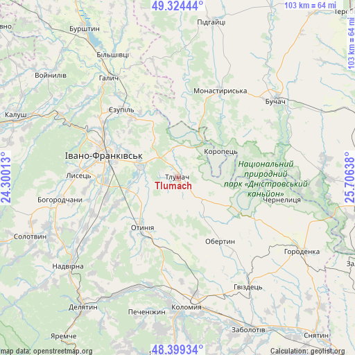
Tlumach GPS coordinates[2]
48° 51' 50.508" North, 25° 0' 11.7" East
| Map corner | latitude | longitude |
|---|---|---|
| Upper-left | 49.32444°, | 24.30013° |
| Center: | 48.86403°, | 25.00325° |
| Lower-right: | 48.39934°, | 25.70638° |
| Map W x H: | 102.9×102.9 km | = 63.9×63.9mi |
| max Lat: | 52.18903° ⇑36.7% North |
| Tlumach: | 48.86403° |
| min Lat: | ⇓63.3% South 44.39214° |
| min Long | Tlumach | max Long |
| 22.20555° | 25.00325° | 40.13222° |
| W 14.1%⇐ | ⇒85.9% E |
Elevation
Elevation of Tlumach is 257 m = 843 ft, and this is 101.2 m = 332 ft above average elevation for this country.
| Max E: |
886 m = 2907 ft | 18.3% |
| Tlumach | 257 m 843 ft | |
| Avg. | 155.8 m = 511 ft | |
Min E: |
-3 m = -10 ft | 81.7% |
See also: Ukraine elevation on elevation.city.
Geographical zone
Tlumach is located in North temperate zone (between Tropic of Cancer and the Arctic Circle). Distance of this North polar circle is 1968 km =1222.9 mi to North.| Distance of | km | miles | from Tlumach |
|---|---|---|---|
| North Pole | 4573.9 | 2842.1 | to North |
| Arctic Circle | 1968 | 1222.9 | to North |
| Tropic Cancer | 2827.3 | 1756.8 | to South |
| Equator | 5433.2 | 3376 | to South |


Nearby cities:
15 places around Tlumach: (largest is in red/bold)
• Chernelytsya
31.4 km =19.5 mi,  100°
100°
• Cherniyiv
21.2 km =13.2 mi,  267°
267°
• Chornoliztsi
8.7 km =5.4 mi,  244°
244°
• Ivano-Frankivsk
22.4 km =13.9 mi,  286°
286°
• Monastyrys’ka
27.9 km =17.3 mi,  26°
26°
• Obertyn
21.9 km =13.6 mi,  146°
146°
• Otyniya
17.5 km =10.9 mi,  216°
216°
• Radcha
25.5 km =15.8 mi, 266°
• Tysmenychany
26.7 km =16.6 mi,  247°
247°
• Tysmenytsya
12.3 km =7.6 mi, 290°
• Uhryniv
24.8 km =15.4 mi, 294°
• Yablonovka
33.9 km =21.1 mi,  70°
70°
• Yamnytsya
25.7 km =16 mi,  302°
302°
• Zahvizdya
26.3 km =16.3 mi,  283°
283°
• Zolotyy Potik
25.1 km =15.6 mi,  78°
78°
Sources, notices
• [Note1] Compared only with cities in Ukraine existing in our database
• [Src1] Map data: © OpenStreetMap contributors (CC-BY-SA)
• [Src2] Other city data from geonames.org with taken over terms of usage.
• [Src3] Geographical zone / Annual Mean Temperature by Robert A. Rohde @ Wikipedia
