Kadiyivka geodata
Kadiyivka (Luhansk) is a seat of a second-order administrative division; located in Ukraine in Europe/Zaporozhye (GMT+3) time zone. With population of 84,425 people, there are 54 cities with bigger population in this country. Compared to other cities in Ukraine, 57.1% of cities are located further ↓South; 97.4% of cities are located further ←West and 73.1% of cities have lower elevation than Kadiyivka. Note1


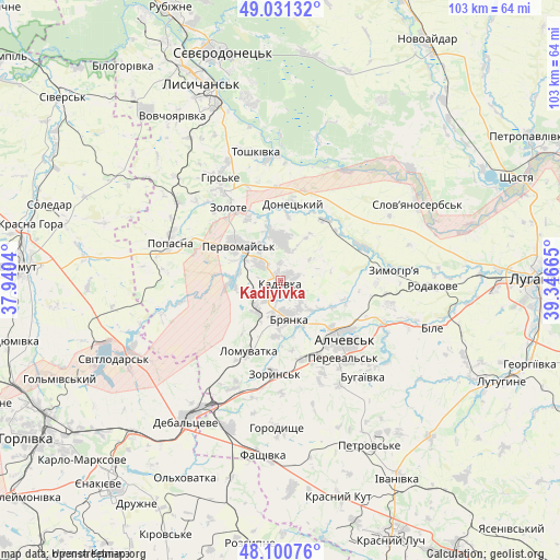
Kadiyivka GPS coordinates[2]
48° 34' 5.448" North, 38° 38' 36.672" East
| Map corner | latitude | longitude |
|---|---|---|
| Upper-left | 49.03132°, | 37.9404° |
| Center: | 48.56818°, | 38.64352° |
| Lower-right: | 48.10076°, | 39.34665° |
| Map W x H: | 103.5×103.5 km | = 64.3×64.3mi |
| max Lat: | 52.18903° ⇑42.9% North |
| Kadiyivka: | 48.56818° |
| min Lat: | ⇓57.1% South 44.39214° |
| min Long | Kadiyivka | max Long |
| 22.20555° | 38.64352° | 40.13222° |
| W 97.4%⇐ | ⇒2.6% E |
Elevation
Elevation of Kadiyivka is 217 m = 712 ft, and this is 61.2 m = 201 ft above average elevation for this country.
| Max E: |
886 m = 2907 ft | 26.9% |
| Kadiyivka | 217 m 712 ft | |
| Avg. | 155.8 m = 511 ft | |
Min E: |
-3 m = -10 ft | 73.1% |
See also: Kadiyivka elevation on elevation.city.
Geographical zone
Kadiyivka is located in North temperate zone (between Tropic of Cancer and the Arctic Circle). Distance of this North polar circle is 2000.9 km =1243.3 mi to North.| Distance of | km | miles | from Kadiyivka |
|---|---|---|---|
| North Pole | 4606.8 | 2862.5 | to North |
| Arctic Circle | 2000.9 | 1243.3 | to North |
| Tropic Cancer | 2794.4 | 1736.4 | to South |
| Equator | 5400.3 | 3355.6 | to South |


Nearby cities:
15 places around Kadiyivka: (largest is in red/bold)
• Alchevs’k
16.9 km =10.5 mi,  130°
130°
• Artemivs’k
15.6 km =9.7 mi,  155°
155°
• Bayrachky
19.8 km =12.3 mi,  188°
188°
• Bryanka
6.7 km =4.2 mi, 161°
• Chornukhyne
28.6 km =17.8 mi,  198°
198°
• Debal’tseve
30.8 km =19.1 mi,  214°
214°
• Hirs’ke
21.5 km =13.4 mi,  329°
329°
• Kirovs’k
7.7 km =4.8 mi,  359°
359°
• Pereval’s’k
20.7 km =12.9 mi, 134°
• Pervomays’k
9.8 km =6.1 mi,  314°
314°
• Popasna
20.8 km =12.9 mi,  290°
290°
• Slov`yanoserbsk
28.7 km =17.8 mi,  59°
59°
• Toshkivka
23.9 km =14.9 mi,  348°
348°
• Zoryns’k
17.4 km =10.8 mi,  184°
184°
• Zymohiria
21.7 km =13.5 mi,  84°
84°
In other languages:
- In Spanish: Stajánov
- In France: Stakhanov, Kadiïvka
- In German: Stachanow
- In Italian: Stachanov
- In Russian: Kadiyevka, Стаханов
- In Chinese: 斯達漢諾夫, 卡季耶夫卡, 卡季伊夫卡
Sources, notices
• [Note1] Compared only with cities in Ukraine existing in our database
• [Src1] Map data: © OpenStreetMap contributors (CC-BY-SA)
• [Src2] Other city data from geonames.org with taken over terms of usage.
• [Src3] Geographical zone / Annual Mean Temperature by Robert A. Rohde @ Wikipedia
