Artemivs’k geodata
Artemivs’k (Luhansk) is a populated place; located in Ukraine in Europe/Zaporozhye (GMT+3) time zone. With population of 7,616 people, there are 473 cities with bigger population in this country. Compared to other cities in Ukraine, 53.8% of cities are located further ↓South; 97.6% of cities are located further ←West and 86.3% of cities have lower elevation than Artemivs’k. Note1


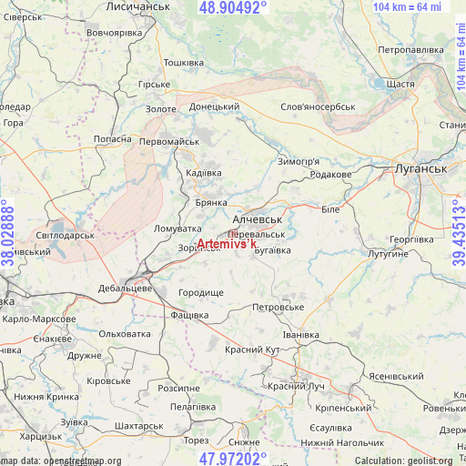
Artemivs’k GPS coordinates[2]
48° 26' 26.196" North, 38° 43' 55.2" East
| Map corner | latitude | longitude |
|---|---|---|
| Upper-left | 48.90492°, | 38.02888° |
| Center: | 48.44061°, | 38.732° |
| Lower-right: | 47.97202°, | 39.43513° |
| Map W x H: | 103.7×103.7 km | = 64.4×64.4mi |
| max Lat: | 52.18903° ⇑46.2% North |
| Artemivs’k: | 48.44061° |
| min Lat: | ⇓53.8% South 44.39214° |
| min Long | Artemivs’k | max Long |
| 22.20555° | 38.732° | 40.13222° |
| W 97.6%⇐ | ⇒2.4% E |
Elevation
Elevation of Artemivs’k is 282 m = 925 ft, and this is 126.2 m = 414 ft above average elevation for this country.
| Max E: |
886 m = 2907 ft | 13.7% |
| Artemivs’k | 282 m 925 ft | |
| Avg. | 155.8 m = 511 ft | |
Min E: |
-3 m = -10 ft | 86.3% |
See also: Ukraine elevation on elevation.city.
Geographical zone
Artemivs’k is located in North temperate zone (between Tropic of Cancer and the Arctic Circle). Distance of this North polar circle is 2015.1 km =1252.1 mi to North.| Distance of | km | miles | from Artemivs’k |
|---|---|---|---|
| North Pole | 4621 | 2871.4 | to North |
| Arctic Circle | 2015.1 | 1252.1 | to North |
| Tropic Cancer | 2780.2 | 1727.5 | to South |
| Equator | 5386.1 | 3346.8 | to South |


Nearby cities:
15 places around Artemivs’k: (largest is in red/bold)
• Alchevs’k
7 km =4.3 mi,  63°
63°
• Bayrachky
11 km =6.8 mi,  240°
240°
• Bile
24.3 km =15.1 mi,  75°
75°
• Bryanka
9 km =5.6 mi,  330°
330°
• Chornukhyne
20.2 km =12.6 mi,  229°
229°
• Debal’tseve
26.6 km =16.5 mi,  245°
245°
• Kadiyivka
15.6 km =9.7 mi,  335°
335°
• Kirovs’k
22.9 km =14.2 mi, 343°
• Krasnyy Kut
27 km =16.8 mi,  169°
169°
• Lenina
30.5 km =19 mi,  92°
92°
• Pereval’s’k
8.3 km =5.2 mi, 92°
• Pervomays’k
25 km =15.5 mi, 327°
• Uspenka
32.3 km =20.1 mi,  99°
99°
• Zoryns’k
8.6 km =5.3 mi, 248°
• Zymohiria
22.1 km =13.7 mi,  43°
43°
Sources, notices
• [Note1] Compared only with cities in Ukraine existing in our database
• [Src1] Map data: © OpenStreetMap contributors (CC-BY-SA)
• [Src2] Other city data from geonames.org with taken over terms of usage.
• [Src3] Geographical zone / Annual Mean Temperature by Robert A. Rohde @ Wikipedia
