Pulyny geodata
Pulyny (Zhytomyr) is a seat of a second-order administrative division; located in Ukraine in Europe/Kiev (GMT+3) time zone. In our database, there are 1661 cities with bigger population. Compared to other cities in Ukraine, 90.3% of cities are located further ↓South; 75.3% of cities are located further →East and 76.8% of cities have lower elevation than Pulyny. Note1


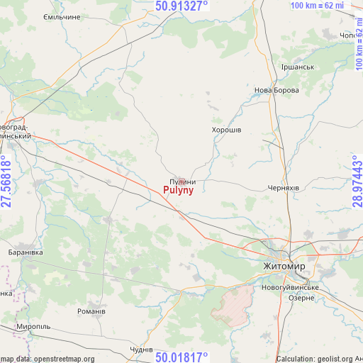
Pulyny GPS coordinates[2]
50° 28' 4.224" North, 28° 16' 16.68" East
| Map corner | latitude | longitude |
|---|---|---|
| Upper-left | 50.91327°, | 27.56818° |
| Center: | 50.46784°, | 28.2713° |
| Lower-right: | 50.01817°, | 28.97443° |
| Map W x H: | 99.5×99.5 km | = 61.8×61.8mi |
| max Lat: | 52.18903° ⇑9.7% North |
| Pulyny: | 50.46784° |
| min Lat: | ⇓90.3% South 44.39214° |
| min Long | Pulyny | max Long |
| 22.20555° | 28.2713° | 40.13222° |
| W 24.7%⇐ | ⇒75.3% E |
Elevation
Elevation of Pulyny is 233 m = 764 ft, and this is 77.2 m = 253 ft above average elevation for this country.
| Max E: |
886 m = 2907 ft | 23.2% |
| Pulyny | 233 m 764 ft | |
| Avg. | 155.8 m = 511 ft | |
Min E: |
-3 m = -10 ft | 76.8% |
See also: Ukraine elevation on elevation.city.
Geographical zone
Pulyny is located in North temperate zone (between Tropic of Cancer and the Arctic Circle). Distance of this North polar circle is 1789.7 km =1112.1 mi to North.| Distance of | km | miles | from Pulyny |
|---|---|---|---|
| North Pole | 4395.6 | 2731.3 | to North |
| Arctic Circle | 1789.7 | 1112.1 | to North |
| Tropic Cancer | 3005.6 | 1867.6 | to South |
| Equator | 5611.5 | 3486.8 | to South |


Nearby cities:
15 places around Pulyny: (largest is in red/bold)
• Baranivka
47.2 km =29.3 mi,  246°
246°
• Bykivka
28.2 km =17.5 mi,  226°
226°
• Cherniakhiv
28.3 km =17.6 mi,  92°
92°
• Chudniv
47.5 km =29.5 mi,  193°
193°
• Denyshi
29.7 km =18.5 mi,  161°
161°
• Dovbysh
22.7 km =14.1 mi,  242°
242°
• Holovyne
39.2 km =24.4 mi, 89°
• Khoroshiv
18.9 km =11.7 mi,  40°
40°
• Nova Borova
35.8 km =22.2 mi,  45°
45°
• Novohrad-Volynskyi
48.4 km =30.1 mi,  286°
286°
• Ozerne
46 km =28.6 mi,  134°
134°
• Polyanka
47.5 km =29.5 mi, 240°
• Romaniv
43 km =26.7 mi,  214°
214°
• Yemil’chyne
55.8 km =34.7 mi,  323°
323°
• Zhytomyr
36.6 km =22.7 mi, 128°
Sources, notices
• [Note1] Compared only with cities in Ukraine existing in our database
• [Src1] Map data: © OpenStreetMap contributors (CC-BY-SA)
• [Src2] Other city data from geonames.org with taken over terms of usage.
• [Src3] Geographical zone / Annual Mean Temperature by Robert A. Rohde @ Wikipedia
