Khoroshiv geodata
Khoroshiv (Zhytomyr) is a seat of a second-order administrative division; located in Ukraine in Europe/Kiev (GMT+3) time zone. In our database, there are 1661 cities with bigger population. Compared to other cities in Ukraine, 92.4% of cities are located further ↓South; 74.9% of cities are located further →East and 70% of cities have lower elevation than Khoroshiv. Note1


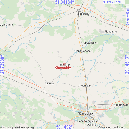
Khoroshiv GPS coordinates[2]
50° 35' 51.504" North, 28° 26' 34.8" East
| Map corner | latitude | longitude |
|---|---|---|
| Upper-left | 51.04184°, | 27.73988° |
| Center: | 50.59764°, | 28.443° |
| Lower-right: | 50.1492°, | 29.14613° |
| Map W x H: | 99.3×99.3 km | = 61.7×61.7mi |
| max Lat: | 52.18903° ⇑7.6% North |
| Khoroshiv: | 50.59764° |
| min Lat: | ⇓92.4% South 44.39214° |
| min Long | Khoroshiv | max Long |
| 22.20555° | 28.443° | 40.13222° |
| W 25.1%⇐ | ⇒74.9% E |
Elevation
Elevation of Khoroshiv is 206 m = 676 ft, and this is 50.2 m = 165 ft above average elevation for this country.
| Max E: |
886 m = 2907 ft | 30% |
| Khoroshiv | 206 m 676 ft | |
| Avg. | 155.8 m = 511 ft | |
Min E: |
-3 m = -10 ft | 70% |
See also: Ukraine elevation on elevation.city.
Geographical zone
Khoroshiv is located in North temperate zone (between Tropic of Cancer and the Arctic Circle). Distance of this North polar circle is 1775.2 km =1103.1 mi to North.| Distance of | km | miles | from Khoroshiv |
|---|---|---|---|
| North Pole | 4381.1 | 2722.3 | to North |
| Arctic Circle | 1775.2 | 1103.1 | to North |
| Tropic Cancer | 3020 | 1876.5 | to South |
| Equator | 5625.9 | 3495.8 | to South |


Nearby cities:
15 places around Khoroshiv: (largest is in red/bold)
• Bykivka
47 km =29.2 mi,  223°
223°
• Cherniakhiv
22.5 km =14 mi,  134°
134°
• Chopovychi
44.5 km =27.7 mi,  53°
53°
• Denyshi
42.7 km =26.5 mi,  183°
183°
• Dovbysh
40.8 km =25.4 mi,  232°
232°
• Holovyne
30.5 km =19 mi,  117°
117°
• Korosten’
42.5 km =26.4 mi,  18°
18°
• Korostyshiv
53.5 km =33.2 mi, 125°
• Luhyny
53.9 km =33.5 mi,  356°
356°
• Nova Borova
17.2 km =10.7 mi, 51°
• Ozerne
51 km =31.7 mi,  156°
156°
• Pulyny
18.9 km =11.7 mi, 220°
• Radomyshl
56.7 km =35.2 mi,  101°
101°
• Yemil’chyne
54.3 km =33.7 mi,  304°
304°
• Zhytomyr
40.5 km =25.2 mi, 155°
Sources, notices
• [Note1] Compared only with cities in Ukraine existing in our database
• [Src1] Map data: © OpenStreetMap contributors (CC-BY-SA)
• [Src2] Other city data from geonames.org with taken over terms of usage.
• [Src3] Geographical zone / Annual Mean Temperature by Robert A. Rohde @ Wikipedia
