Ozerne geodata
Ozerne (Zhytomyr) is a populated place; located in Ukraine in Europe/Kiev (GMT+3) time zone. With population of 5,646 people, there are 595 cities with bigger population in this country. Compared to other cities in Ukraine, 86.2% of cities are located further ↓South; 73.7% of cities are located further →East and 74% of cities have lower elevation than Ozerne. Note1


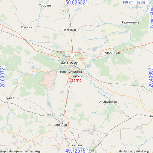
Ozerne GPS coordinates[2]
50° 10' 41.376" North, 28° 44' 1.824" East
| Map corner | latitude | longitude |
|---|---|---|
| Upper-left | 50.62632°, | 28.03072° |
| Center: | 50.17816°, | 28.73384° |
| Lower-right: | 49.72575°, | 29.43697° |
| Map W x H: | 100.1×100.1 km | = 62.2×62.2mi |
| max Lat: | 52.18903° ⇑13.8% North |
| Ozerne: | 50.17816° |
| min Lat: | ⇓86.2% South 44.39214° |
| min Long | Ozerne | max Long |
| 22.20555° | 28.73384° | 40.13222° |
| W 26.3%⇐ | ⇒73.7% E |
Elevation
Elevation of Ozerne is 220 m = 722 ft, and this is 64.2 m = 211 ft above average elevation for this country.
| Max E: |
886 m = 2907 ft | 26% |
| Ozerne | 220 m 722 ft | |
| Avg. | 155.8 m = 511 ft | |
Min E: |
-3 m = -10 ft | 74% |
See also: Ukraine elevation on elevation.city.
Geographical zone
Ozerne is located in North temperate zone (between Tropic of Cancer and the Arctic Circle). Distance of this North polar circle is 1821.9 km =1132.1 mi to North.| Distance of | km | miles | from Ozerne |
|---|---|---|---|
| North Pole | 4427.8 | 2751.3 | to North |
| Arctic Circle | 1821.9 | 1132.1 | to North |
| Tropic Cancer | 2973.4 | 1847.6 | to South |
| Equator | 5579.3 | 3466.8 | to South |


Nearby cities:
15 places around Ozerne: (largest is in red/bold)
• Andrushivka
26.7 km =16.6 mi,  130°
130°
• Berdychiv
32.4 km =20.1 mi,  196°
196°
• Brovky Pershi
43 km =26.7 mi, 129°
• Cherniakhiv
31.3 km =19.4 mi,  351°
351°
• Chervone
27.2 km =16.9 mi,  159°
159°
• Chornorudka
43.7 km =27.2 mi,  147°
147°
• Chudniv
46.1 km =28.6 mi,  252°
252°
• Denyshi
23.8 km =14.8 mi,  279°
279°
• Holovyne
33.2 km =20.6 mi,  11°
11°
• Hryshkivtsi
28.6 km =17.8 mi, 198°
• Khoroshiv
51 km =31.7 mi,  336°
336°
• Korostyshiv
27.7 km =17.2 mi,  56°
56°
• Pulyny
46 km =28.6 mi,  314°
314°
• Radomyshl
49.9 km =31 mi,  44°
44°
• Zhytomyr
10.5 km =6.5 mi, 337°
Sources, notices
• [Note1] Compared only with cities in Ukraine existing in our database
• [Src1] Map data: © OpenStreetMap contributors (CC-BY-SA)
• [Src2] Other city data from geonames.org with taken over terms of usage.
• [Src3] Geographical zone / Annual Mean Temperature by Robert A. Rohde @ Wikipedia
