Radyvyliv geodata
Radyvyliv (Rivne) is a seat of a second-order administrative division; located in Ukraine in Europe/Kiev (GMT+3) time zone. With population of 9,928 people, there are 363 cities with bigger population in this country. Compared to other cities in Ukraine, 85.7% of cities are located further ↓South; 84.9% of cities are located further →East and 74.2% of cities have lower elevation than Radyvyliv. Note1


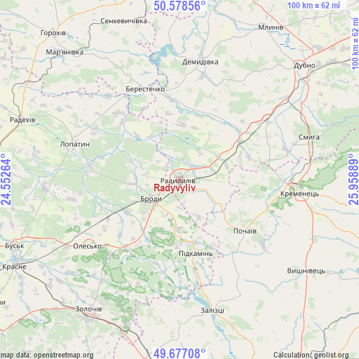
Radyvyliv GPS coordinates[2]
50° 7' 47.784" North, 25° 15' 20.736" East
| Map corner | latitude | longitude |
|---|---|---|
| Upper-left | 50.57856°, | 24.55264° |
| Center: | 50.12994°, | 25.25576° |
| Lower-right: | 49.67708°, | 25.95889° |
| Map W x H: | 100.2×100.2 km | = 62.3×62.3mi |
| max Lat: | 52.18903° ⇑14.3% North |
| Radyvyliv: | 50.12994° |
| min Lat: | ⇓85.7% South 44.39214° |
| min Long | Radyvyliv | max Long |
| 22.20555° | 25.25576° | 40.13222° |
| W 15.1%⇐ | ⇒84.9% E |
Elevation
Elevation of Radyvyliv is 221 m = 725 ft, and this is 65.2 m = 214 ft above average elevation for this country.
| Max E: |
886 m = 2907 ft | 25.8% |
| Radyvyliv | 221 m 725 ft | |
| Avg. | 155.8 m = 511 ft | |
Min E: |
-3 m = -10 ft | 74.2% |
See also: Ukraine elevation on elevation.city.
Geographical zone
Radyvyliv is located in North temperate zone (between Tropic of Cancer and the Arctic Circle). Distance of this North polar circle is 1827.2 km =1135.4 mi to North.| Distance of | km | miles | from Radyvyliv |
|---|---|---|---|
| North Pole | 4433.1 | 2754.6 | to North |
| Arctic Circle | 1827.2 | 1135.4 | to North |
| Tropic Cancer | 2968 | 1844.2 | to South |
| Equator | 5573.9 | 3463.5 | to South |


Nearby cities:
15 places around Radyvyliv: (largest is in red/bold)
• Berestechko
27.6 km =17.1 mi,  338°
338°
• Brody
8.9 km =5.5 mi,  238°
238°
• Demydivka
33.6 km =20.9 mi,  9°
9°
• Dubno
46.6 km =29 mi,  46°
46°
• Kremenets
33.6 km =20.9 mi,  96°
96°
• Kulykiv
37.3 km =23.2 mi,  303°
303°
• Lopatyn
30.7 km =19.1 mi,  289°
289°
• Olesko
31.9 km =19.8 mi,  234°
234°
• Pidhirtsi
28.4 km =17.6 mi,  223°
223°
• Pidkamin’
20.9 km =13 mi,  167°
167°
• Pochaiv
23 km =14.3 mi,  127°
127°
• Smyga
38.3 km =23.8 mi,  71°
71°
• Tarakaniv
42.5 km =26.4 mi, 49°
• Zaliztsi
38.5 km =23.9 mi, 167°
• Zolochiv
44.3 km =27.5 mi, 215°
Sources, notices
• [Note1] Compared only with cities in Ukraine existing in our database
• [Src1] Map data: © OpenStreetMap contributors (CC-BY-SA)
• [Src2] Other city data from geonames.org with taken over terms of usage.
• [Src3] Geographical zone / Annual Mean Temperature by Robert A. Rohde @ Wikipedia
