Zaliztsi geodata
Zaliztsi (Ternopil) is a populated place; located in Ukraine in Europe/Kiev (GMT+3) time zone. With population of 2,612 people, there are 1012 cities with bigger population in this country. Compared to other cities in Ukraine, 79.4% of cities are located further ↓South; 84.2% of cities are located further →East and 94.8% of cities have lower elevation than Zaliztsi. Note1


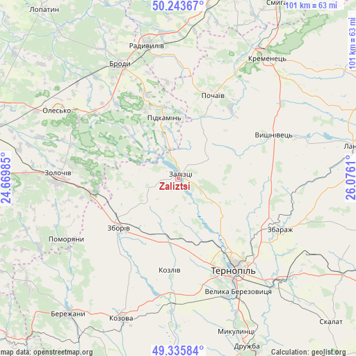
Zaliztsi GPS coordinates[2]
49° 47' 30.768" North, 25° 22' 22.692" East
| Map corner | latitude | longitude |
|---|---|---|
| Upper-left | 50.24367°, | 24.66985° |
| Center: | 49.79188°, | 25.37297° |
| Lower-right: | 49.33584°, | 26.0761° |
| Map W x H: | 100.9×100.9 km | = 62.7×62.7mi |
| max Lat: | 52.18903° ⇑20.6% North |
| Zaliztsi: | 49.79188° |
| min Lat: | ⇓79.4% South 44.39214° |
| min Long | Zaliztsi | max Long |
| 22.20555° | 25.37297° | 40.13222° |
| W 15.8%⇐ | ⇒84.2% E |
Elevation
Elevation of Zaliztsi is 360 m = 1181 ft, and this is 204.2 m = 670 ft above average elevation for this country.
| Max E: |
886 m = 2907 ft | 5.2% |
| Zaliztsi | 360 m 1181 ft | |
| Avg. | 155.8 m = 511 ft | |
Min E: |
-3 m = -10 ft | 94.8% |
See also: Ukraine elevation on elevation.city.
Geographical zone
Zaliztsi is located in North temperate zone (between Tropic of Cancer and the Arctic Circle). Distance of this North polar circle is 1864.8 km =1158.7 mi to North.| Distance of | km | miles | from Zaliztsi |
|---|---|---|---|
| North Pole | 4470.7 | 2778 | to North |
| Arctic Circle | 1864.8 | 1158.7 | to North |
| Tropic Cancer | 2930.4 | 1820.9 | to South |
| Equator | 5536.3 | 3440.1 | to South |


Nearby cities:
15 places around Zaliztsi: (largest is in red/bold)
• Brody
36.6 km =22.7 mi,  334°
334°
• Nadrichne
41.3 km =25.7 mi,  225°
225°
• Olesko
39.2 km =24.4 mi,  298°
298°
• Ozerna
18.4 km =11.4 mi,  189°
189°
• Petrikov
32.6 km =20.3 mi,  152°
152°
• Pidhirtsi
33 km =20.5 mi, 301°
• Pidkamin’
17.6 km =10.9 mi,  346°
346°
• Pochaiv
25.7 km =16 mi,  22°
22°
• Pomoriany
36 km =22.4 mi,  242°
242°
• Radyvyliv
38.5 km =23.9 mi, 347°
• Ternopil
30.7 km =19.1 mi, 149°
• Velikiye Borki
40.7 km =25.3 mi,  137°
137°
• Zbarazh
32.3 km =20.1 mi,  116°
116°
• Zboriv
21.9 km =13.6 mi, 229°
• Zolochiv
34.4 km =21.4 mi,  272°
272°
Sources, notices
• [Note1] Compared only with cities in Ukraine existing in our database
• [Src1] Map data: © OpenStreetMap contributors (CC-BY-SA)
• [Src2] Other city data from geonames.org with taken over terms of usage.
• [Src3] Geographical zone / Annual Mean Temperature by Robert A. Rohde @ Wikipedia
