Berezivka geodata
Berezivka (Kharkiv) is a populated place; located in Ukraine in Europe/Kiev (GMT+3) time zone. With population of 1,618 people, there are 1188 cities with bigger population in this country. Compared to other cities in Ukraine, 73.8% of cities are located further ↓South; 85.2% of cities are located further ←West and 55.4% of cities have higher elevation than Berezivka. Note1


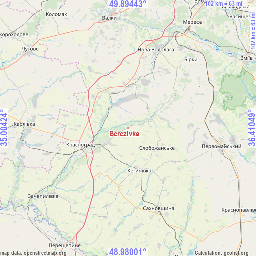
Berezivka GPS coordinates[2]
49° 26' 21.66" North, 35° 42' 26.496" East
| Map corner | latitude | longitude |
|---|---|---|
| Upper-left | 49.89443°, | 35.00424° |
| Center: | 49.43935°, | 35.70736° |
| Lower-right: | 48.98001°, | 36.41049° |
| Map W x H: | 101.7×101.7 km | = 63.2×63.2mi |
| max Lat: | 52.18903° ⇑26.2% North |
| Berezivka: | 49.43935° |
| min Lat: | ⇓73.8% South 44.39214° |
| min Long | Berezivka | max Long |
| 22.20555° | 35.70736° | 40.13222° |
| W 85.2%⇐ | ⇒14.8% E |
Elevation
Elevation of Berezivka is 119 m = 390 ft, and this is 36.8 m = 121 ft below average elevation for this country.
| Max E: |
886 m = 2907 ft | 55.4% |
| Avg. | 155.8 m = 511 ft | |
| Berezivka | 119 m = 390 ft | |
Min E: |
-3 m = -10 ft | 44.6% |
See also: Ukraine elevation on elevation.city.
Geographical zone
Berezivka is located in North temperate zone (between Tropic of Cancer and the Arctic Circle). Distance of this North polar circle is 1904 km =1183.1 mi to North.| Distance of | km | miles | from Berezivka |
|---|---|---|---|
| North Pole | 4509.9 | 2802.3 | to North |
| Arctic Circle | 1904 | 1183.1 | to North |
| Tropic Cancer | 2891.2 | 1796.5 | to South |
| Equator | 5497.1 | 3415.7 | to South |


Nearby cities:
15 places around Berezivka: (largest is in red/bold)
• Chapayeve
14.6 km =9.1 mi,  123°
123°
• Chutove
49.3 km =30.6 mi,  307°
307°
• Karlivka
41.8 km =26 mi,  272°
272°
• Kehychivka
17.4 km =10.8 mi,  166°
166°
• Krasnohrad
20.3 km =12.6 mi,  251°
251°
• Merefa
49.3 km =30.6 mi,  30°
30°
• Nova Vodolaha
33.1 km =20.6 mi,  20°
20°
• Pervomays’kyy
37.2 km =23.1 mi,  98°
98°
• Sakhnovshchyna
34.1 km =21.2 mi,  159°
159°
• Tymchenky
39.6 km =24.6 mi,  127°
127°
• Utkivka
46.8 km =29.1 mi, 34°
• Valky
44.6 km =27.7 mi,  351°
351°
• Varvarivka
38.2 km =23.7 mi,  286°
286°
• Verbivka
12.8 km =8 mi,  258°
258°
• Zachepylivka
43.5 km =27 mi,  231°
231°
Sources, notices
• [Note1] Compared only with cities in Ukraine existing in our database
• [Src1] Map data: © OpenStreetMap contributors (CC-BY-SA)
• [Src2] Other city data from geonames.org with taken over terms of usage.
• [Src3] Geographical zone / Annual Mean Temperature by Robert A. Rohde @ Wikipedia
