Zachepylivka geodata
Zachepylivka (Kharkiv) is a seat of a second-order administrative division; located in Ukraine in Europe/Kiev (GMT+3) time zone. With population of 4,217 people, there are 734 cities with bigger population in this country. Compared to other cities in Ukraine, 69.8% of cities are located further ↓South; 82.7% of cities are located further ←West and 67.7% of cities have higher elevation than Zachepylivka. Note1


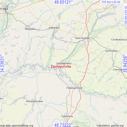
Zachepylivka GPS coordinates[2]
49° 11' 37.86" North, 35° 14' 21.948" East
| Map corner | latitude | longitude |
|---|---|---|
| Upper-left | 49.65121°, | 34.53631° |
| Center: | 49.19385°, | 35.23943° |
| Lower-right: | 48.73222°, | 35.94256° |
| Map W x H: | 102.2×102.2 km | = 63.5×63.5mi |
| max Lat: | 52.18903° ⇑30.2% North |
| Zachepylivka: | 49.19385° |
| min Lat: | ⇓69.8% South 44.39214° |
| min Long | Zachepylivka | max Long |
| 22.20555° | 35.23943° | 40.13222° |
| W 82.7%⇐ | ⇒17.3% E |
Elevation
Elevation of Zachepylivka is 82 m = 269 ft, and this is 73.8 m = 242 ft below average elevation for this country.
| Max E: |
886 m = 2907 ft | 67.7% |
| Avg. | 155.8 m = 511 ft | |
| Zachepylivka | 82 m = 269 ft | |
Min E: |
-3 m = -10 ft | 32.3% |
See also: Ukraine elevation on elevation.city.
Geographical zone
Zachepylivka is located in North temperate zone (between Tropic of Cancer and the Arctic Circle). Distance of this North polar circle is 1931.3 km =1200.1 mi to North.| Distance of | km | miles | from Zachepylivka |
|---|---|---|---|
| North Pole | 4537.2 | 2819.3 | to North |
| Arctic Circle | 1931.3 | 1200.1 | to North |
| Tropic Cancer | 2863.9 | 1779.5 | to South |
| Equator | 5469.8 | 3398.8 | to South |


Nearby cities:
15 places around Zachepylivka: (largest is in red/bold)
• Berezivka
43.5 km =27 mi,  51°
51°
• Chapayeve
49.9 km =31 mi,  67°
67°
• Chutove
57.7 km =35.9 mi,  354°
354°
• Hubynykha
42.7 km =26.5 mi,  178°
178°
• Hupalivka
37.8 km =23.5 mi,  255°
255°
• Karlivka
30.3 km =18.8 mi,  344°
344°
• Kehychivka
39.3 km =24.4 mi, 74°
• Khashchevoye
55.2 km =34.3 mi,  172°
172°
• Krasnohrad
25.4 km =15.8 mi,  35°
35°
• Mahdalynivka
38.5 km =23.9 mi,  217°
217°
• Mashivka
38.7 km =24 mi,  315°
315°
• Sakhnovshchyna
46.2 km =28.7 mi,  95°
95°
• Spas’ke
60.2 km =37.4 mi,  193°
193°
• Varvarivka
38.4 km =23.9 mi,  355°
355°
• Verbivka
32.7 km =20.3 mi, 40°
Sources, notices
• [Note1] Compared only with cities in Ukraine existing in our database
• [Src1] Map data: © OpenStreetMap contributors (CC-BY-SA)
• [Src2] Other city data from geonames.org with taken over terms of usage.
• [Src3] Geographical zone / Annual Mean Temperature by Robert A. Rohde @ Wikipedia
