Beregovoye geodata
Beregovoye (Republic of Crimea) is a populated place; located in Ukraine in Europe/Simferopol (GMT+3) time zone. With population of 2,377 people, there are 1049 cities with bigger population in this country. Compared to other cities in Ukraine, 88.4% of cities are located further ↑North; 84.2% of cities are located further ←West and 98% of cities have higher elevation than Beregovoye. Note1


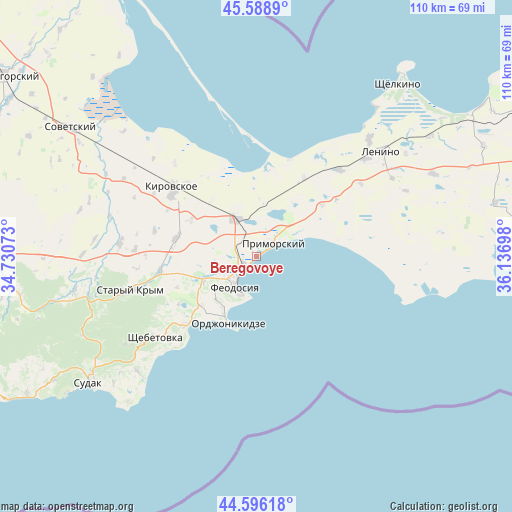
Beregovoye GPS coordinates[2]
45° 5' 40.92" North, 35° 26' 1.86" East
| Map corner | latitude | longitude |
|---|---|---|
| Upper-left | 45.5889°, | 34.73073° |
| Center: | 45.0947°, | 35.43385° |
| Lower-right: | 44.59618°, | 36.13698° |
| Map W x H: | 110.4×110.4 km | = 68.6×68.6mi |
| max Lat: | 52.18903° ⇑88.4% North |
| Beregovoye: | 45.0947° |
| min Lat: | ⇓11.6% South 44.39214° |
| min Long | Beregovoye | max Long |
| 22.20555° | 35.43385° | 40.13222° |
| W 84.2%⇐ | ⇒15.8% E |
Elevation
Elevation of Beregovoye is 7 m = 23 ft, and this is 148.8 m = 488 ft below average elevation for this country.
| Max E: |
886 m = 2907 ft | 98% |
| Avg. | 155.8 m = 511 ft | |
| Beregovoye | 7 m = 23 ft | |
Min E: |
-3 m = -10 ft | 2% |
See also: Ukraine elevation on elevation.city.
Geographical zone
Beregovoye is located in North temperate zone (between Tropic of Cancer and the Arctic Circle). Distance of this North polar circle is 2387.1 km =1483.3 mi to North.| Distance of | km | miles | from Beregovoye |
|---|---|---|---|
| North Pole | 4993 | 3102.5 | to North |
| Arctic Circle | 2387.1 | 1483.3 | to North |
| Tropic Cancer | 2408.1 | 1496.3 | to South |
| Equator | 5014.1 | 3115.6 | to South |


Nearby cities:
15 places around Beregovoye: (largest is in red/bold)
• Batal’noye
18 km =11.2 mi,  52°
52°
• Blizhneye
9.1 km =5.7 mi,  242°
242°
• Feodosiya
7.8 km =4.8 mi,  214°
214°
• Koktebel
20.9 km =13 mi,  224°
224°
• Nasypnoe
11.9 km =7.4 mi,  247°
247°
• Novopokrovka
16.2 km =10.1 mi,  298°
298°
• Ordzhonikidze
15.8 km =9.8 mi,  202°
202°
• Pervomayskoye
21.5 km =13.4 mi,  260°
260°
• Primorskiy
4.5 km =2.8 mi, 53°
• Semisotka
19.8 km =12.3 mi,  31°
31°
• Sinitsyno
21.7 km =13.5 mi,  317°
317°
• Solnechnoye
8.7 km =5.4 mi,  232°
232°
• Vladislavovka
9.3 km =5.8 mi,  331°
331°
• Yarkoye Pole
22.2 km =13.8 mi, 303°
• Zhuravki
17.5 km =10.9 mi,  281°
281°
Sources, notices
• [Note1] Compared only with cities in Ukraine existing in our database
• [Src1] Map data: © OpenStreetMap contributors (CC-BY-SA)
• [Src2] Other city data from geonames.org with taken over terms of usage.
• [Src3] Geographical zone / Annual Mean Temperature by Robert A. Rohde @ Wikipedia
