Bilyts’ke geodata
Bilyts’ke (Donetsk) is a populated place; located in Ukraine in Europe/Kiev (GMT+3) time zone. With population of 9,718 people, there are 371 cities with bigger population in this country. Compared to other cities in Ukraine, 53% of cities are located further ↓South; 91.4% of cities are located further ←West and 66.8% of cities have lower elevation than Bilyts’ke. Note1


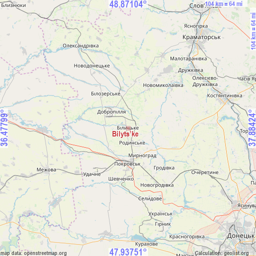
Bilyts’ke GPS coordinates[2]
48° 24' 23.112" North, 37° 10' 51.996" East
| Map corner | latitude | longitude |
|---|---|---|
| Upper-left | 48.87104°, | 36.47799° |
| Center: | 48.40642°, | 37.18111° |
| Lower-right: | 47.93751°, | 37.88424° |
| Map W x H: | 103.8×103.8 km | = 64.5×64.5mi |
| max Lat: | 52.18903° ⇑47% North |
| Bilyts’ke: | 48.40642° |
| min Lat: | ⇓53% South 44.39214° |
| min Long | Bilyts’ke | max Long |
| 22.20555° | 37.18111° | 40.13222° |
| W 91.4%⇐ | ⇒8.6% E |
Elevation
Elevation of Bilyts’ke is 193 m = 633 ft, and this is 37.2 m = 122 ft above average elevation for this country.
| Max E: |
886 m = 2907 ft | 33.2% |
| Bilyts’ke | 193 m 633 ft | |
| Avg. | 155.8 m = 511 ft | |
Min E: |
-3 m = -10 ft | 66.8% |
See also: Ukraine elevation on elevation.city.
Geographical zone
Bilyts’ke is located in North temperate zone (between Tropic of Cancer and the Arctic Circle). Distance of this North polar circle is 2018.9 km =1254.5 mi to North.| Distance of | km | miles | from Bilyts’ke |
|---|---|---|---|
| North Pole | 4624.8 | 2873.7 | to North |
| Arctic Circle | 2018.9 | 1254.5 | to North |
| Tropic Cancer | 2776.4 | 1725.2 | to South |
| Equator | 5382.3 | 3344.4 | to South |


Nearby cities:
15 places around Bilyts’ke: (largest is in red/bold)
• Dobropillya
9.4 km =5.8 mi,  310°
310°
• Druzhkivka
37 km =23 mi,  47°
47°
• Kostyantynivka
41 km =25.5 mi,  70°
70°
• Kramators’k
44.7 km =27.8 mi,  38°
38°
• Krasnotorka
40.1 km =24.9 mi, 40°
• Kurakhovo
47.4 km =29.5 mi,  170°
170°
• Mezhova
37.1 km =23.1 mi,  242°
242°
• Myrnohrad
12.7 km =7.9 mi,  152°
152°
• Novodonets’ke
29.3 km =18.2 mi,  330°
330°
• Oleksandrivka
38.8 km =24.1 mi, 329°
• Pokrovsk
13.8 km =8.6 mi,  181°
181°
• Rodyns’ke
6.3 km =3.9 mi,  163°
163°
• Selydove
30.2 km =18.8 mi, 162°
• Shcherbynivka
45 km =28 mi,  91°
91°
• Toretsk
49.2 km =30.6 mi, 91°
Sources, notices
• [Note1] Compared only with cities in Ukraine existing in our database
• [Src1] Map data: © OpenStreetMap contributors (CC-BY-SA)
• [Src2] Other city data from geonames.org with taken over terms of usage.
• [Src3] Geographical zone / Annual Mean Temperature by Robert A. Rohde @ Wikipedia
