Mezhova geodata
Mezhova (Dnipropetrovsk) is a seat of a second-order administrative division; located in Ukraine in Europe/Kiev (GMT+3) time zone. With population of 7,817 people, there are 458 cities with bigger population in this country. Compared to other cities in Ukraine, 51% of cities are located further ↑North; 90.3% of cities are located further ←West and 63.5% of cities have lower elevation than Mezhova. Note1


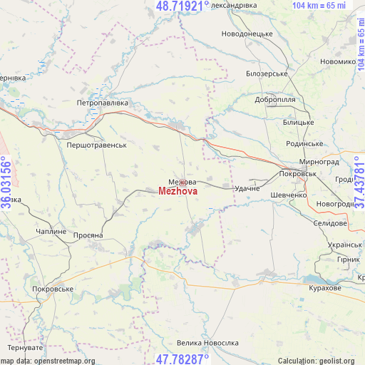
Mezhova GPS coordinates[2]
48° 15' 11.448" North, 36° 44' 4.848" East
| Map corner | latitude | longitude |
|---|---|---|
| Upper-left | 48.71921°, | 36.03156° |
| Center: | 48.25318°, | 36.73468° |
| Lower-right: | 47.78287°, | 37.43781° |
| Map W x H: | 104.1×104.1 km | = 64.7×64.7mi |
| max Lat: | 52.18903° ⇑51% North |
| Mezhova: | 48.25318° |
| min Lat: | ⇓49% South 44.39214° |
| min Long | Mezhova | max Long |
| 22.20555° | 36.73468° | 40.13222° |
| W 90.3%⇐ | ⇒9.7% E |
Elevation
Elevation of Mezhova is 181 m = 594 ft, and this is 25.2 m = 83 ft above average elevation for this country.
| Max E: |
886 m = 2907 ft | 36.5% |
| Mezhova | 181 m 594 ft | |
| Avg. | 155.8 m = 511 ft | |
Min E: |
-3 m = -10 ft | 63.5% |
See also: Ukraine elevation on elevation.city.
Geographical zone
Mezhova is located in North temperate zone (between Tropic of Cancer and the Arctic Circle). Distance of this North polar circle is 2035.9 km =1265 mi to North.| Distance of | km | miles | from Mezhova |
|---|---|---|---|
| North Pole | 4641.8 | 2884.3 | to North |
| Arctic Circle | 2035.9 | 1265 | to North |
| Tropic Cancer | 2759.3 | 1714.5 | to South |
| Equator | 5365.3 | 3333.8 | to South |


Nearby cities:
15 places around Mezhova: (largest is in red/bold)
• Bilyts’ke
37.1 km =23.1 mi,  62°
62°
• Dobropillya
34.7 km =21.6 mi,  48°
48°
• Kurakhovo
50.4 km =31.3 mi,  126°
126°
• Mar'yinka
66.7 km =41.4 mi,  120°
120°
• Myrnohrad
39.4 km =24.5 mi,  81°
81°
• Novodonets’ke
46.3 km =28.8 mi,  23°
23°
• Oleksandrivka
52.3 km =32.5 mi,  14°
14°
• Petropavlivka
31.6 km =19.6 mi,  315°
315°
• Pokrovsk
32.8 km =20.4 mi, 84°
• Pokrovs’ke
48.6 km =30.2 mi,  231°
231°
• Rodyns’ke
36.6 km =22.7 mi,  72°
72°
• Selydove
43.5 km =27 mi,  105°
105°
• Ternuvate
65.2 km =40.5 mi,  223°
223°
• Vasyl’kivka
52.9 km =32.9 mi,  264°
264°
• Velyka Novosilka
46 km =28.6 mi,  170°
170°
Sources, notices
• [Note1] Compared only with cities in Ukraine existing in our database
• [Src1] Map data: © OpenStreetMap contributors (CC-BY-SA)
• [Src2] Other city data from geonames.org with taken over terms of usage.
• [Src3] Geographical zone / Annual Mean Temperature by Robert A. Rohde @ Wikipedia
