Perekop geodata
Perekop (Republic of Crimea) is a populated place; located in Ukraine in Europe/Simferopol (GMT+3) time zone. With population of 919 people, there are 1421 cities with bigger population in this country. Compared to other cities in Ukraine, 68.8% of cities are located further ↑North; 55.3% of cities are located further ←West and 93.7% of cities have higher elevation than Perekop. Note1


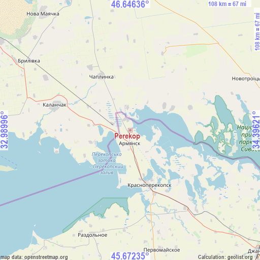
Perekop GPS coordinates[2]
46° 9' 41.436" North, 33° 41' 35.088" East
| Map corner | latitude | longitude |
|---|---|---|
| Upper-left | 46.64636°, | 32.98996° |
| Center: | 46.16151°, | 33.69308° |
| Lower-right: | 45.67235°, | 34.39621° |
| Map W x H: | 108.3×108.3 km | = 67.3×67.3mi |
| max Lat: | 52.18903° ⇑68.8% North |
| Perekop: | 46.16151° |
| min Lat: | ⇓31.2% South 44.39214° |
| min Long | Perekop | max Long |
| 22.20555° | 33.69308° | 40.13222° |
| W 55.3%⇐ | ⇒44.7% E |
Elevation
Elevation of Perekop is 14 m = 46 ft, and this is 141.8 m = 465 ft below average elevation for this country.
| Max E: |
886 m = 2907 ft | 93.7% |
| Avg. | 155.8 m = 511 ft | |
| Perekop | 14 m = 46 ft | |
Min E: |
-3 m = -10 ft | 6.3% |
See also: Ukraine elevation on elevation.city.
Geographical zone
Perekop is located in North temperate zone (between Tropic of Cancer and the Arctic Circle). Distance of this North polar circle is 2268.5 km =1409.6 mi to North.| Distance of | km | miles | from Perekop |
|---|---|---|---|
| North Pole | 4874.4 | 3028.8 | to North |
| Arctic Circle | 2268.5 | 1409.6 | to North |
| Tropic Cancer | 2526.8 | 1570.1 | to South |
| Equator | 5132.7 | 3189.3 | to South |


Nearby cities:
15 places around Perekop: (largest is in red/bold)
• Armyansk
5.8 km =3.6 mi,  180°
180°
• Askaniya-Nova
34.9 km =21.7 mi,  22°
22°
• Chaplynka
25.5 km =15.8 mi,  332°
332°
• Filatovka
11.3 km =7 mi,  141°
141°
• Ishun’
28.3 km =17.6 mi,  159°
159°
• Kalanchak
32.7 km =20.3 mi,  288°
288°
• Krasnoarmeyskoye
32.2 km =20 mi,  126°
126°
• Krasnoperekops’k
24.1 km =15 mi, 160°
• Pochetnoye
19.4 km =12.1 mi, 163°
• Risovoye
14.9 km =9.3 mi, 180°
• Sovkhoznoye
23.2 km =14.4 mi, 164°
• Suvorovo
8.1 km =5 mi, 182°
• Tavricheskoye
21 km =13 mi,  168°
168°
• Vishnyovka
30.1 km =18.7 mi, 138°
• Zelyonaya Niva
29.5 km =18.3 mi,  148°
148°
Sources, notices
• [Note1] Compared only with cities in Ukraine existing in our database
• [Src1] Map data: © OpenStreetMap contributors (CC-BY-SA)
• [Src2] Other city data from geonames.org with taken over terms of usage.
• [Src3] Geographical zone / Annual Mean Temperature by Robert A. Rohde @ Wikipedia
